Difference between revisions of "2016-07-09 54 10"
imported>ZettS |
imported>Malgond m (→Expedition) |
||
| Line 43: | Line 43: | ||
I stopped at every intersection (sometimes they where hart to spot in the dark) to get the right direction. | I stopped at every intersection (sometimes they where hart to spot in the dark) to get the right direction. | ||
I never drove or went this paths before. A really good idea to do this at night... | I never drove or went this paths before. A really good idea to do this at night... | ||
| − | Finally I reached the old village of Suchsdorf, drove under the Eckernförder street and got into the new quarter where every street is named after islands and locations of the Baltic and North Sea. The destination street is named after the polish | + | Finally I reached the old village of Suchsdorf, drove under the Eckernförder street and got into the new quarter where every street is named after islands and locations of the Baltic and North Sea. The destination street is named after the polish island and town of Wolin. |
I was there at midnight an tried to take some photos . But it was really dark there, too, and the flash didn't work well so this was the first time I used the Geohash Droid and to take a Screenshot of the arrival. | I was there at midnight an tried to take some photos . But it was really dark there, too, and the flash didn't work well so this was the first time I used the Geohash Droid and to take a Screenshot of the arrival. | ||
Revision as of 08:27, 12 July 2016
| Sat 9 Jul 2016 in 54,10: 54.3635402, 10.0775782 geohashing.info google osm bing/os kml crox |
Location
Wolliner Weg in Kiel.
Participants
Plans
The last expedition is long ago, but this one is so close. I hopefully manage to stop by at this point. - ZettS (talk) 13:50, 8 July 2016 (UTC)
Expedition
This was another part of "Let's do stupid things!" This time: Why not try a Midnight-Tron-By-Bike. But first things first.
I wasn't so active in the last four month. Mostly because there was too much to do for me or the coordinates where in unreachable distance by bike and/or public transportation wasn't good. But this time this hashpoint was so close it would be a shame not to visit it. Also this this one would be a good possibility for a first Tron. But there was a Problem: I was ging to visit my girlfrind on Saturday and start early with the bus. But I really wanted to get this hashpoint after such a long time. And if I got a plan I rarely let it go. So I was thinking: Hm, I could do it at midnight. I've never done this befor either. But walking at this time would be too long so let's take a bike. This is where stupid ideas come from. But it went well.
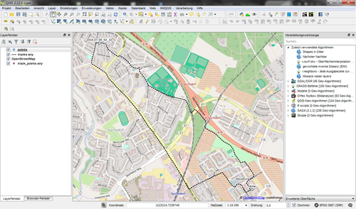
I started at 23:30 with the bike in north-western dirction through the allotment gardens and unlit paths through bushes and shrubs. Lights where only every (estimated) 200 metres. It was really dark. I stopped at every intersection (sometimes they where hart to spot in the dark) to get the right direction. I never drove or went this paths before. A really good idea to do this at night... Finally I reached the old village of Suchsdorf, drove under the Eckernförder street and got into the new quarter where every street is named after islands and locations of the Baltic and North Sea. The destination street is named after the polish island and town of Wolin.
I was there at midnight an tried to take some photos . But it was really dark there, too, and the flash didn't work well so this was the first time I used the Geohash Droid and to take a Screenshot of the arrival.
The Was back was much more easier. It was along the the Eckernförder Street and at last some shortcut through another allotment. So I reached my home from south-west. and went to bed around 0:20.
Tracklog
Achievements
ZettS earned the Midnight Geohash achievement
|
ZettS earned the Tron achievement
|


