Difference between revisions of "2016-09-22 32 -85"
imported>Million zillion (→Gallery) |
imported>Million zillion |
||
| Line 10: | Line 10: | ||
== Graticule == | == Graticule == | ||
| − | [ | + | [[Auburn,_Alabama|Auburn, Alabama]] |
== About == | == About == | ||
| Line 22: | Line 22: | ||
=== [[User:Million zillion|Million zillion]] === | === [[User:Million zillion|Million zillion]] === | ||
| + | This geohash expedition is a continuation of the trip for the [[2016-09-22_global|2016-09-22 globalhash]]. To sum that up, the two of us set off from Atlanta, Georgia to the globalhash in Alabama, west of Selma and Montgomery, and on the way back we chose to take a detour off of I-85 for the daily geohash in this graticule. We needed to be back to Atlanta by 6pm to return the rental car, but it looked like we had enough time to reach this hashpoint and then get back to our return route. | ||
| + | |||
| + | For most of this trip we had depended on directions mainly from NWoodruff's trusty GPS, which he had programmed for the globalhash before we left. This impromptu geohash wasn't programmed into the GPS, so we had to depend on my cell phone instead for navigation. Google Maps gave us inconsistent directions each time we checked it (exit 50? 42? 38?) We eventually settled on exit 38 (north of Tuskeegee) for AL-81 north, a two-lane rural road. It looked like many of the exits from AL-81 were unpaved county roads, and NWoodruff expressed concern that we might have to travel some considerable distance (in a small rental car) on roads like that. My impression was that state roads would take us most of the way to the hashpoint and would likely be paved, so we could at least get close before we ran into any such obstacle. | ||
| + | |||
| + | After 6.7 miles, AL-81 took us into Notasulga, a small town with - as far I could tell - one traffic light. AL-81 turned into E. Main Street, which branched off to AL-14 east. After 4.7 miles on AL-14 (mostly parallel to railroad tracks) we turned onto County Road 188 for a quarter mile, and then parked at the edge of the field with the hashpoint at about 2:15pm. | ||
| + | |||
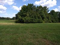
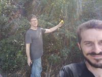
| + | We walked about 400 feet to the standing of trees that contained the hashpoint. Tracing the outer edge of the trees, we could only get within about 50 feet of it. NWoodruff entered the coordinates from the geohashing app in my phone into his GPS as a waypoint to get a more precise fix. The vegetation thinned out a bit around the north edge of the trees, creating a potential entry point to get closer to the hashpoint, but the undergrowth was still too dense to easily walk into it. NWoodruff charged right in with his GPS and got a very close fix. | ||
| + | |||
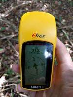
| + | I didn't like the look of the vegetation - I imagined spending another two hours in the car with a poison oak rash, and I was all set to accept an [[MNB_Geohash|MNB]] consolation prize for this one. When NWoodruff returned to the open field, he handed me the GPS and told me I just had to get with 32 feet (10 meters) for this to count as "reaching" the hashpoint. So I stumbled into the brush far enough for the GPS to report a distance of 31.5 feet, and called it a success. I don't think this counts as a [[MNIMB_Geohash|MNIMB]] achievement, since it would have been much less threatening if I had simply worn jeans that day instead of shorts... | ||
| + | |||
| + | For the return trip, we took AL-14 further east, through Loachapoka, which is a bit larger than Notasulga and includes some historical site that we didn't get a close look at. I forget the exact route we took back to I-85 from there (maybe NWoodruff has a tracklog?) but it ended with Beehive Road and Cox Road at exit 50. | ||
| + | |||
| + | From there, the return journey was a standard run on I-85 NE to the I-285 Atlanta perimeter at about 5pm. There was some considerable traffic on the perimeter and the alternate routes to Norcross, and we spent much of the time from this point discussing the fastest route to choose. In the end, we just took the perimeter east and then north, accepting that traffic delay as at least more ''reliable'' than what we might find closer in to Atlanta. In the end, we reached NWoodruff's home at 6:04pm, and I returned home from there myself. NWoodruff will have to report for himself whether he was able to return the car in time. | ||
== Gallery == | == Gallery == | ||
| Line 38: | Line 51: | ||
== Achievements == | == Achievements == | ||
| + | {{Multihash2 | ||
| + | |||
| + | | date = 2016-09-22 | ||
| + | | count = 2 | ||
| + | | name = NWoodruff and Million zillion | ||
| + | | image = 2016-09-22_32_-85_entry.jpg | ||
| + | |||
| + | }} | ||
[[Category:Expeditions]] | [[Category:Expeditions]] | ||
[[Category:Expeditions with photos]] | [[Category:Expeditions with photos]] | ||
[[Category:Coordinates reached]] | [[Category:Coordinates reached]] | ||
Revision as of 19:37, 25 September 2016
| Thu 22 Sep 2016 in Auburn Alabama: 32.5971571, -85.6089214 geohashing.info google osm bing/os kml crox |
Contents
Graticule
About
On the outskirts of a field in some bushes.
Expedition
NWoodruff
Million zillion
This geohash expedition is a continuation of the trip for the 2016-09-22 globalhash. To sum that up, the two of us set off from Atlanta, Georgia to the globalhash in Alabama, west of Selma and Montgomery, and on the way back we chose to take a detour off of I-85 for the daily geohash in this graticule. We needed to be back to Atlanta by 6pm to return the rental car, but it looked like we had enough time to reach this hashpoint and then get back to our return route.
For most of this trip we had depended on directions mainly from NWoodruff's trusty GPS, which he had programmed for the globalhash before we left. This impromptu geohash wasn't programmed into the GPS, so we had to depend on my cell phone instead for navigation. Google Maps gave us inconsistent directions each time we checked it (exit 50? 42? 38?) We eventually settled on exit 38 (north of Tuskeegee) for AL-81 north, a two-lane rural road. It looked like many of the exits from AL-81 were unpaved county roads, and NWoodruff expressed concern that we might have to travel some considerable distance (in a small rental car) on roads like that. My impression was that state roads would take us most of the way to the hashpoint and would likely be paved, so we could at least get close before we ran into any such obstacle.
After 6.7 miles, AL-81 took us into Notasulga, a small town with - as far I could tell - one traffic light. AL-81 turned into E. Main Street, which branched off to AL-14 east. After 4.7 miles on AL-14 (mostly parallel to railroad tracks) we turned onto County Road 188 for a quarter mile, and then parked at the edge of the field with the hashpoint at about 2:15pm.
We walked about 400 feet to the standing of trees that contained the hashpoint. Tracing the outer edge of the trees, we could only get within about 50 feet of it. NWoodruff entered the coordinates from the geohashing app in my phone into his GPS as a waypoint to get a more precise fix. The vegetation thinned out a bit around the north edge of the trees, creating a potential entry point to get closer to the hashpoint, but the undergrowth was still too dense to easily walk into it. NWoodruff charged right in with his GPS and got a very close fix.
I didn't like the look of the vegetation - I imagined spending another two hours in the car with a poison oak rash, and I was all set to accept an MNB consolation prize for this one. When NWoodruff returned to the open field, he handed me the GPS and told me I just had to get with 32 feet (10 meters) for this to count as "reaching" the hashpoint. So I stumbled into the brush far enough for the GPS to report a distance of 31.5 feet, and called it a success. I don't think this counts as a MNIMB achievement, since it would have been much less threatening if I had simply worn jeans that day instead of shorts...
For the return trip, we took AL-14 further east, through Loachapoka, which is a bit larger than Notasulga and includes some historical site that we didn't get a close look at. I forget the exact route we took back to I-85 from there (maybe NWoodruff has a tracklog?) but it ended with Beehive Road and Cox Road at exit 50.
From there, the return journey was a standard run on I-85 NE to the I-285 Atlanta perimeter at about 5pm. There was some considerable traffic on the perimeter and the alternate routes to Norcross, and we spent much of the time from this point discussing the fastest route to choose. In the end, we just took the perimeter east and then north, accepting that traffic delay as at least more reliable than what we might find closer in to Atlanta. In the end, we reached NWoodruff's home at 6:04pm, and I returned home from there myself. NWoodruff will have to report for himself whether he was able to return the car in time.
Gallery
NWoodruff
- Photo Gallery
Million zillion
Achievements
NWoodruff and Million zillion earned the Multihash Achievement
|


