Difference between revisions of "2017-01-25 48 11"
imported>Claralucia9 (→Photos) |
imported>Claralucia9 (→Photos) |
||
| Line 46: | Line 46: | ||
Image:2017-01-25_16.14.04.png|at the hash coordinates - logproof | Image:2017-01-25_16.14.04.png|at the hash coordinates - logproof | ||
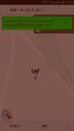
| − | Image:2017-01-25_48_11_Claralucia9_1485365290891.jpg|In the middle of a snow field | + | Image:2017-01-25_48_11_Claralucia9_1485365290891.jpg|In the middle of a snow field |
</gallery> | </gallery> | ||
Revision as of 18:46, 25 January 2017
| Wed 25 Jan 2017 in 48,11: 48.0235137, 11.6983487 geohashing.info google osm bing/os kml crox |
Location
On a field near Höhenkirchen-Siegertsbrunn
Participants
claralucia9
Plans
Solli plans to go there around 5:30 p.m.
Expedition
claralucia9: What a coincidence: I've been looking at the hash coordinates for over a month now and they've been too far away all the time, but suddenly I get two close by in one week! Hence I had to get in the car this evening and drive over to Höhenkirchen. Parked my car at the road side and started to walk along a bicycle track a bit. Then I had to walk straight into a field. Luckily it's winter time and no crops got damaged. Leaving my footprints in the snow I made it to the coordinates. No other footprints around so I guess I may have been the only one here today. Took my pictures and then back to the warmth of the car. On my way back I tried to log a geocache, but were unlucky this time....
Tracklog
Photos
at the hash coordinates - logproof

In the middle of a snow field


Achievements