Difference between revisions of "2017-01-31 48 9"
From Geohashing
imported>Klaus (template) |
imported>Klaus (expedition - didn't reach) |
||
| Line 1: | Line 1: | ||
| − | + | [[Image:{{{image|2017-01-31_48_9_hash.jpg}}}|thumb|left]] | |
| − | |||
| − | |||
| − | |||
| − | |||
| − | |||
| − | |||
| − | |||
{{meetup graticule | {{meetup graticule | ||
| lat=48 | | lat=48 | ||
| Line 15: | Line 8: | ||
}} | }} | ||
| − | |||
__NOTOC__ | __NOTOC__ | ||
== Location == | == Location == | ||
| − | + | Im Pfarrboschen, Neckartailfingen | |
== Participants == | == Participants == | ||
| − | + | * [[User:Klaus|Klaus]] | |
| − | |||
== Plans == | == Plans == | ||
| − | + | I noticed it while working. As I was on my way back to Tuebingen on the evening and driving | |
== Expedition == | == Expedition == | ||
| − | + | It would have been an easy one. However, the B297 between Nuertingen and Neckartailfingen is under construction at the moment which I didn't know in advance. | |
| + | So I had to drive a small detour through Nuertingen-Raidwangen anyway. | ||
| + | |||
| + | As it was raining and I was in formal attire, I decided not to go crazy and walk over the muddy field to reach the geohash. If it only had been as cold as all other days in January, it'd have been possible to easily reach it because the mud would have been frozen ... | ||
| − | |||
| − | |||
== Photos == | == Photos == | ||
| − | |||
| − | |||
| − | |||
<gallery perrow="5"> | <gallery perrow="5"> | ||
| + | Image:2017-01-31_48_9_proof.png | Screenshot of GeohashDroid | ||
| + | Image:2017-01-31_48_9_car.jpg | My Car | ||
| + | Image:2017-01-31_48_9_hash.jpg | The hash is around 100m in this direction. | ||
| + | Image:2017-01-31_48_9_formal_attire.jpg | Proof of formal attire | ||
</gallery> | </gallery> | ||
== Achievements == | == Achievements == | ||
| − | |||
| − | |||
| − | |||
| − | |||
| − | |||
| − | |||
| − | |||
| − | |||
| − | |||
| − | |||
| − | |||
| − | |||
| − | |||
| − | |||
| − | |||
| − | |||
| − | |||
[[Category:Expeditions]] | [[Category:Expeditions]] | ||
| − | |||
[[Category:Expeditions with photos]] | [[Category:Expeditions with photos]] | ||
| − | |||
| − | |||
| − | |||
| − | |||
| − | |||
| − | |||
| − | |||
| − | |||
| − | |||
[[Category:Coordinates not reached]] | [[Category:Coordinates not reached]] | ||
| − | |||
| − | |||
[[Category:Not reached - Mother Nature]] | [[Category:Not reached - Mother Nature]] | ||
| − | |||
| − | |||
| − | |||
| − | |||
| − | |||
| − | |||
| − | |||
| − | |||
| − | |||
| − | |||
| − | |||
Revision as of 20:27, 1 February 2017

| Tue 31 Jan 2017 in 48,9: 48.6132645, 9.2882342 geohashing.info google osm bing/os kml crox |
Location
Im Pfarrboschen, Neckartailfingen
Participants
Plans
I noticed it while working. As I was on my way back to Tuebingen on the evening and driving
Expedition
It would have been an easy one. However, the B297 between Nuertingen and Neckartailfingen is under construction at the moment which I didn't know in advance. So I had to drive a small detour through Nuertingen-Raidwangen anyway.
As it was raining and I was in formal attire, I decided not to go crazy and walk over the muddy field to reach the geohash. If it only had been as cold as all other days in January, it'd have been possible to easily reach it because the mud would have been frozen ...
Photos
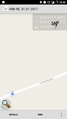
Screenshot of GeohashDroid
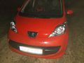
My Car

The hash is around 100m in this direction.
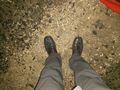
Proof of formal attire


