Difference between revisions of "2017-05-12 48 8"
From Geohashing
imported>Klaus (template) |
imported>Klaus (expedition) |
||
| Line 1: | Line 1: | ||
| + | [[Image:{{{image|2017-05-12_48_8_200829_Voehrenbach.jpg}}}|thumb|left]] | ||
| − | |||
| − | |||
| − | |||
| − | |||
| − | |||
| − | |||
| − | |||
| − | |||
| − | |||
{{meetup graticule | {{meetup graticule | ||
| lat=48 | | lat=48 | ||
| Line 15: | Line 7: | ||
}} | }} | ||
| − | |||
__NOTOC__ | __NOTOC__ | ||
== Location == | == Location == | ||
| − | + | meadow near Vöhrenbach, Black Forest, Germany | |
== Participants == | == Participants == | ||
| − | + | * [[User:Klaus|Klaus]] | |
| − | + | * his girlfriend | |
== Plans == | == Plans == | ||
| − | + | On our way to Black Forest for a weekend vacation, this geohash was conveniently on our way, in fact it was near to one of the two routes Google Maps suggested. | |
== Expedition == | == Expedition == | ||
| − | + | The expedition itself was quite unspectacular: drive with the car, stop at the street 100m away, walk to the geohash, take photos and drive along. | |
| + | |||
| + | However, it's my first time I got two consecutive (successful) geohashes so it was still kind of special ;) | ||
| − | |||
| − | |||
== Photos == | == Photos == | ||
| − | |||
| − | |||
| − | |||
<gallery perrow="5"> | <gallery perrow="5"> | ||
| + | Image:2017-05-12_48_8_195806_Proof_Transport.jpg | Proof of transportation (car) | ||
| + | Image:2017-05-12_48_8_195911_view_to_geohash.jpg | Somewhere in front of me is the geohash | ||
| + | Image:2017-05-12_48_8_200008_view_from_hash1.jpg | View from geohash #1 | ||
| + | Image:2017-05-12_48_8_200011_view_from_hash2.jpg | View from geohash #2 | ||
| + | Image:2017-05-12_48_8_200014_view_from_hash3.jpg | View from geohash #3 | ||
| + | Image:2017-05-12_48_8_200017_view_from_hash4.jpg | View from geohash #4 | ||
| + | Image:2017-05-12_48_8_200028_Hashorama.jpg | Hash-o-rama | ||
| + | Image:2017-05-12_48_8_200058_Dandelions.jpg | Lots of dandelions here | ||
| + | Image:2017-05-12_48_8_200829_Voehrenbach.jpg | beautiful Black Forest village Vöhrenbach (1km after the geohash) | ||
</gallery> | </gallery> | ||
== Achievements == | == Achievements == | ||
{{#vardefine:ribbonwidth|800px}} | {{#vardefine:ribbonwidth|800px}} | ||
| − | |||
| − | + | {{land geohash | |
| − | + | | latitude = 48 | |
| − | [[ | + | | longitude = 8 |
| + | | date = 2015-05-12 | ||
| + | | name = [[User:Klaus|Klaus]] | ||
| + | }} | ||
| − | + | {{Template:Drag-along | |
| − | + | | latitude = 48 | |
| − | + | | longitude = 8 | |
| − | + | | date = 2017-05-12 | |
| − | [[ | + | | name = [[User:Klaus|Klaus]] |
| − | + | | partner = his girlfriend | |
| + | }} | ||
| − | + | {{consecutive geohash 3 | |
| − | + | | hashcount = 2 | |
| − | + | | daycount = 2 | |
| + | | latitude = 48 | ||
| + | | longitude = 9 | ||
| + | | date = 2017-05-11 | ||
| + | | name = [[User:Klaus|Klaus]] | ||
| + | }} | ||
[[Category:Expeditions]] | [[Category:Expeditions]] | ||
| − | |||
[[Category:Expeditions with photos]] | [[Category:Expeditions with photos]] | ||
| − | |||
| − | |||
| − | |||
| − | |||
| − | |||
[[Category:Coordinates reached]] | [[Category:Coordinates reached]] | ||
| − | |||
| − | |||
| − | |||
| − | |||
| − | |||
| − | |||
| − | |||
| − | |||
| − | |||
| − | |||
| − | |||
| − | |||
| − | |||
| − | |||
| − | |||
| − | |||
| − | |||
| − | |||
Revision as of 20:01, 14 May 2017

| Fri 12 May 2017 in 48,8: 48.0609050, 8.3182712 geohashing.info google osm bing/os kml crox |
Location
meadow near Vöhrenbach, Black Forest, Germany
Participants
- Klaus
- his girlfriend
Plans
On our way to Black Forest for a weekend vacation, this geohash was conveniently on our way, in fact it was near to one of the two routes Google Maps suggested.
Expedition
The expedition itself was quite unspectacular: drive with the car, stop at the street 100m away, walk to the geohash, take photos and drive along.
However, it's my first time I got two consecutive (successful) geohashes so it was still kind of special ;)
Photos

Proof of transportation (car)

Somewhere in front of me is the geohash

View from geohash #1

View from geohash #2

View from geohash #3

View from geohash #4

Hash-o-rama
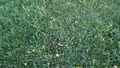
Lots of dandelions here
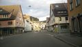
beautiful Black Forest village Vöhrenbach (1km after the geohash)


Achievements
Klaus earned the Land geohash achievement
|
Klaus earned the Drag-along achievement
|
Klaus earned the Consecutive geohash achievement
|