Difference between revisions of "2017-06-19 51 9"
From Geohashing
imported>GeorgDerReisende (new report) |
imported>GeorgDerReisende (expedition report for Breuna-Niederlistingen) |
||
| Line 1: | Line 1: | ||
| − | |||
| − | |||
| − | |||
| − | |||
| − | |||
| − | |||
| − | |||
| − | |||
| − | |||
| − | |||
{{meetup graticule | {{meetup graticule | ||
| lat=51 | | lat=51 | ||
| Line 19: | Line 9: | ||
== Location == | == Location == | ||
| − | + | ||
| + | The hash lay on the edge of a field east of Niederlistingen. | ||
== Participants == | == Participants == | ||
| − | + | ||
| − | + | [[User:GeorgDerReisende|GeorgDerReisende]] | |
== Plans == | == Plans == | ||
| − | + | ||
| + | ??? | ||
== Expedition == | == Expedition == | ||
| − | |||
| − | + | I left home at 9 o'clock. I started to hitchhike at the roundabout near the airport at 10:15. I arrived at Niederlistingen at 10:36. There I walked through the village to its eastern end. In the fields I found the hash, three meters in the field. I walked to Oberlistingen. I started to hitchhike at 12:50 and at 13:50, with one car, I arrived just at my doorstep. | |
| − | |||
== Photos == | == Photos == | ||
| − | |||
| − | |||
| − | |||
<gallery perrow="5"> | <gallery perrow="5"> | ||
| + | Image:2017-06-19 51 9 GeorgDerReisende 6995.jpg | the Teichweg in Niederlistingen leads to the hash | ||
| + | Image:2017-06-19 51 9 GeorgDerReisende 7000.jpg | 20 m to hash | ||
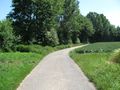
| + | Image:2017-06-19 51 9 GeorgDerReisende 7001.jpg | 9 m to hash | ||
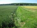
| + | Image:2017-06-19 51 9 GeorgDerReisende 7002.jpg | hash is three meters in the field | ||
| + | Image:2017-06-19 51 9 GeorgDerReisende 7003.jpg | the north | ||
| + | Image:2017-06-19 51 9 GeorgDerReisende 7004.jpg | the east | ||
| + | Image:2017-06-19 51 9 GeorgDerReisende 7005.jpg | the south | ||
| + | Image:2017-06-19 51 9 GeorgDerReisende 7006.jpg | the west | ||
| + | Image:2017-06-19 51 9 GeorgDerReisende 7007.jpg | the geohasher | ||
| + | Image:2017-06-19 51 9 GeorgDerReisende 7032.jpg | the site from above | ||
</gallery> | </gallery> | ||
| Line 45: | Line 42: | ||
<!-- Add any achievement ribbons you earned below, or remove this section --> | <!-- Add any achievement ribbons you earned below, or remove this section --> | ||
| − | + | {{Thumbs Up | latitude = 51 | longitude = 9 | date = 2017-06-19 | name = GeorgDerReisende }} | |
| − | |||
| − | |||
| − | + | [[Category:Expeditions]] | |
| − | + | [[Category:Expeditions with photos]] | |
| − | |||
| − | |||
| − | |||
| − | |||
| − | |||
| − | |||
| − | |||
| − | |||
| − | |||
| − | |||
| − | |||
| − | |||
| − | |||
| − | |||
[[Category:Coordinates reached]] | [[Category:Coordinates reached]] | ||
| − | |||
| − | |||
| − | |||
| − | |||
| − | |||
| − | |||
| − | |||
| − | |||
| − | |||
| − | |||
| − | |||
| − | |||
| − | |||
| − | |||
| − | |||
| − | |||
| − | |||
| − | |||
Revision as of 13:28, 19 June 2017
| Mon 19 Jun 2017 in 51,9: 51.4490471, 9.2616888 geohashing.info google osm bing/os kml crox |
Location
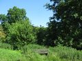
The hash lay on the edge of a field east of Niederlistingen.
Participants
Plans
???
Expedition
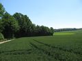
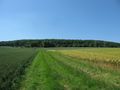
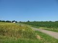
I left home at 9 o'clock. I started to hitchhike at the roundabout near the airport at 10:15. I arrived at Niederlistingen at 10:36. There I walked through the village to its eastern end. In the fields I found the hash, three meters in the field. I walked to Oberlistingen. I started to hitchhike at 12:50 and at 13:50, with one car, I arrived just at my doorstep.
Photos
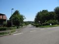
the Teichweg in Niederlistingen leads to the hash
20 m to hash
9 m to hash
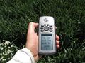
hash is three meters in the field
the north
the east
the south
the west
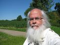
the geohasher
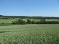
the site from above


Achievements
GeorgDerReisende earned the Thumbs Up Geohash Achievement
|