Difference between revisions of "2017-09-24 34 -97"
From Geohashing
imported>Thunk ([live picture]Buuuuut...) |
imported>Jiml m (Add ribbon indicator and cats) |
||
| Line 15: | Line 15: | ||
}} | }} | ||
| − | + | ||
__NOTOC__ | __NOTOC__ | ||
== Location == | == Location == | ||
| − | + | ||
| + | South of Norman | ||
== Participants == | == Participants == | ||
| − | + | ||
| − | + | * [[User:Thunk|Thunk]] | |
== Plans == | == Plans == | ||
<!-- what were the original plans --> | <!-- what were the original plans --> | ||
| + | |||
| + | Unknown | ||
| + | |||
== Expedition == | == Expedition == | ||
| Line 33: | Line 37: | ||
*Probably not quite a success. Got to within 20 m of the hashpoint before being stopped by barbed wire fence. -- [[User:Thunk|Thunk]] ([[User talk:Thunk|talk]]) [http://www.openstreetmap.org/?lat=34.99794730&lon=-97.38872920&zoom=16&layers=B000FTF @34.9979,-97.3887] 20:25, 24 September 2017 (GMT+00:00) | *Probably not quite a success. Got to within 20 m of the hashpoint before being stopped by barbed wire fence. -- [[User:Thunk|Thunk]] ([[User talk:Thunk|talk]]) [http://www.openstreetmap.org/?lat=34.99794730&lon=-97.38872920&zoom=16&layers=B000FTF @34.9979,-97.3887] 20:25, 24 September 2017 (GMT+00:00) | ||
| + | |||
| + | |||
== Tracklog == | == Tracklog == | ||
<!-- if your GPS device keeps a log, you may post a link here --> | <!-- if your GPS device keeps a log, you may post a link here --> | ||
| Line 40: | Line 46: | ||
Image:2012-##-## ## ## Alpha.jpg | Witty Comment | Image:2012-##-## ## ## Alpha.jpg | Witty Comment | ||
--> | --> | ||
| + | |||
<gallery perrow="5"> | <gallery perrow="5"> | ||
| − | |||
Image:2017-09-24_34_-97_thunk_1506284733607.jpg|Buuuuut... | Image:2017-09-24_34_-97_thunk_1506284733607.jpg|Buuuuut... | ||
</gallery> | </gallery> | ||
| Line 47: | Line 53: | ||
== Achievements == | == Achievements == | ||
{{#vardefine:ribbonwidth|800px}} | {{#vardefine:ribbonwidth|800px}} | ||
| − | |||
| − | + | * No Trespassing | |
| − | |||
| − | |||
| − | |||
| − | |||
| − | |||
| − | |||
| − | |||
| − | |||
| − | |||
| − | |||
| − | |||
| − | |||
[[Category:Expeditions]] | [[Category:Expeditions]] | ||
| − | |||
[[Category:Expeditions with photos]] | [[Category:Expeditions with photos]] | ||
| − | |||
| − | |||
| − | |||
| − | |||
| − | |||
| − | |||
| − | |||
| − | |||
| − | |||
[[Category:Coordinates not reached]] | [[Category:Coordinates not reached]] | ||
| − | |||
| − | |||
| − | |||
| − | |||
| − | |||
[[Category:Not reached - No public access]] | [[Category:Not reached - No public access]] | ||
| − | |||
| − | |||
| − | |||
| − | |||
| − | |||
| − | |||
| − | |||
| − | |||
Revision as of 14:05, 28 September 2017
| Sun 24 Sep 2017 in 34,-97: 34.9979263, -97.3890080 geohashing.info google osm bing/os kml crox |
Location
South of Norman
Participants
Plans
Unknown
Expedition
- Probably not quite a success. Got to within 20 m of the hashpoint before being stopped by barbed wire fence. -- Thunk (talk) @34.9979,-97.3887 20:25, 24 September 2017 (GMT+00:00)
Tracklog
Photos
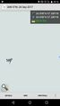
Buuuuut...

Achievements
- No Trespassing