Difference between revisions of "2008-05-31 39 -119"
imported>Paveman (The first Reno meetup with an official page!) |
imported>Thomcat (Success/failure category added) |
||
| Line 22: | Line 22: | ||
| date=2008-05-31 | | date=2008-05-31 | ||
}} | }} | ||
| + | |||
| + | [[Category:Expeditions]] | ||
| + | [[Category:Expeditions with photos]] | ||
| + | [[Category:Coordinates reached]] | ||
Revision as of 20:40, 6 August 2008
Marginally successfully visited by User:Paveman.
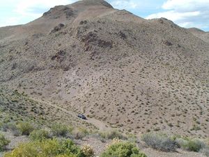
Having read the contour map of the area, I knew the area was rugged. I didn't expect the official location to be reachable only by climbers, if not people with much better gear than mine.
I drove from Sparks to the site in a Camry. While this Camry had been driven across horse ranches before, it wasn't prepared for the narrow, windy switchbacks that passed for roads. Certainly, the drive on Interstate 80 and US 95 Alternate was as gorgeous as on-roading gets. About two miles past the end of Luzier Lane's pavement, however, I felt at least one wheel was no longer in contact with the ground. Because Camrys are not designed for such conditions, I parked the car and hiked to the summit of a nearby hill.
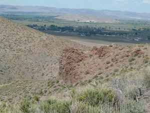
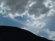
This summit provided some fantastic panoramas, and I hope the photos do them justice. The weather was quite pleasant, and the juxtaposition of rocky desert hills with a green agricultural valley floor was enjoyable. Additionally, I was visited by a lizard, who looked at me curiously, then caught some rays on a bush.
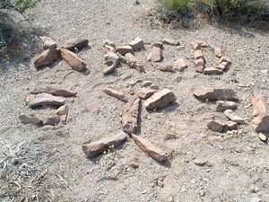
After leaving a mark on the site, and struggling to point my car in the other direction, I made my way back down the hill. Not far from the end of the pavement is the Gordon and Martha Diehl Archery Range. This range is open to the public, and didn't have any on-site staffers at the time of my visit. This range is also the home of the Walker River Bowmen, an archery club. Next time the hash brings a Yerington visit, I would encourage hashers to bring bows. The kind that propel arrows, not the kind you tie ribbons into. Although, if you have a bow on your bow, I'd look at it curiously.
I've uploaded all the photos I snapped at this meetup location to my Flickr album.
| Sat 31 May 2008 in 39,-119: 39.0374871, -119.2812665 geohashing.info google osm bing/os kml crox |


