Difference between revisions of "2018-08-26 50 11"
From Geohashing
imported>Reinhard (photos to come) |
imported>FippeBot m (Location) |
||
| Line 30: | Line 30: | ||
[[Category:Expeditions with photos]] | [[Category:Expeditions with photos]] | ||
[[Category:Coordinates reached]] | [[Category:Coordinates reached]] | ||
| + | {{location|DE|TH|AP}} | ||
Latest revision as of 04:00, 16 August 2019
| Sun 26 Aug 2018 in 50,11: 50.9215015, 11.3355937 geohashing.info google osm bing/os kml crox |
Location
At the end of a dead end in Buchfart, Thuringia, Germany.
Participants
Expedition
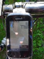
When cycling from Erfurt to Jena, Buchfart is on my standard route. The hashpoint in Buchfart just came on the right day coinciding with my plans and only requiring me to take a detour of 500 m to get to it without even leaving the road. Too easy!
Tracklog
Photos
|

