Difference between revisions of "2019-01-17 45 -88"
imported>FippeBot m (Location) |
imported>Fippe (coordinates reached) |
||
| Line 67: | Line 67: | ||
}} | }} | ||
| − | |||
| − | |||
| − | |||
| − | |||
| − | |||
| − | |||
| − | |||
| − | |||
| − | |||
| − | |||
| − | |||
| − | |||
| − | |||
| − | |||
[[Category:Expeditions]] | [[Category:Expeditions]] | ||
| − | |||
[[Category:Expeditions with photos]] | [[Category:Expeditions with photos]] | ||
| − | |||
| − | |||
| − | |||
{{location|US|WI|MN}} | {{location|US|WI|MN}} | ||
| − | |||
| − | |||
[[Category:Coordinates reached]] | [[Category:Coordinates reached]] | ||
| − | |||
| − | |||
| − | |||
| − | |||
| − | |||
| − | |||
| − | |||
| − | |||
| − | |||
| − | |||
| − | |||
| − | |||
| − | |||
| − | |||
| − | |||
| − | |||
| − | |||
| − | |||
Revision as of 17:30, 26 July 2019
| Thu 17 Jan 2019 in 45,-88: 45.0342457, -88.7666205 geohashing.info google osm bing/os kml crox |
Location
A Bureau of Indian Affairs road near Neopit, Wisconsin.
Participants
Just little old me, WausauBill (talk)
Plans
It was going to be a rare day when I was finished with work early in the afternoon. The hash was in the next graticule over from me, but on Google maps it appeared to be in an open area less then 50 feet from the road. Seemed like an easy attempt for a weekday.
Expedition
OK, so maybe "easy" was not the correct adjective.
While I was at work there was a dusting of snow, which in my area quickly disappeared from the roads. However, as I found as I drove toward the hash that the area where I was going got a bit more snow and perhaps has less traffic, so the roads were a bit slippery which turned a planned 50 minute drive into almost an hour and a half.
I also found out that while my home graticule was pretty much clear of snow on the ground, this was not the case where I was going. True there was not much snow by Wisconsin standards,but more than I was expecting.
When I got to the vicinity of the spot, I found that it was not an open area I was at, but rather a dense growth of small thin trees (what we call "popple" here.) So, I was faced with foot and half of snow berm and pretty much impenetrable forest growth in a blanket of snow.
However, at that moment the GPS gods smiled on me (probably because of poor reception out in the middle of nowhere) and the app indicated I was close enough to the hash to call it good. Which has lead to a new rule of thumb, "If the phone says you are there, screenshot immediately and ask questions later."
The drive back home was uneventful, the roads having improved a bit since I drove out. Got back just in time to make dinner.
Photos
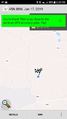
Proof shot

Unemcumbered Me


