Difference between revisions of "2019-04-14 62 30"
imported>Kripakko |
imported>Kripakko m |
||
| Line 75: | Line 75: | ||
<!-- Potential categories. Please include all the ones appropriate to your expedition --> | <!-- Potential categories. Please include all the ones appropriate to your expedition --> | ||
| − | |||
| − | |||
| + | [[Category:Expeditions]] | ||
| + | [[Category:Coordinates reached]] | ||
| + | [[Category:Expeditions with photos]] | ||
<!-- If all those plans are never acted upon, change [[Category:Expedition planning]] to [[Category:Not reached - Did not attempt]]. --> | <!-- If all those plans are never acted upon, change [[Category:Expedition planning]] to [[Category:Not reached - Did not attempt]]. --> | ||
Revision as of 17:40, 14 April 2019
| Sun 14 Apr 2019 in 62,30: 62.6625758, 30.1490940 geohashing.info google osm bing/os kml crox |
Location
In a forest near the village of Selkie, close to small forest roads.
Participants
Plans
I plan to reach this geohash by cycling here from Joensuu. In summer or autumn, I could easily cycle to 60 metres away and walk to the hashpoint, but now I cannot count on the small forest roads being clear of snow. Since these forest roads are probably not maintained in winter, there may still be too much snow (easily more than ten centimetres) for cycling. In the worst case scenario, I will have to walk about 1.5 kilometres from Keskijärventie, but it is still a manageable distance.

Expedition
Success, reporting soon...
Photos
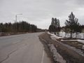
Major road to Ilomantsi.
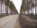
Smaller road to Selkie.
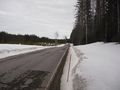
Further down the road, looking more snowy.
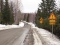
Village road of Selkie.
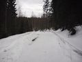
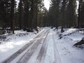
Forest road towards the hashpoint.
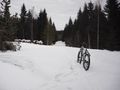
My trusty geomobile.
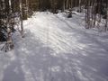
My track in the snow.
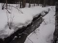
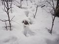
A ditch in the forest.
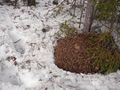
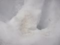
A live anthill.
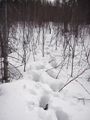
More of my track in the snow.
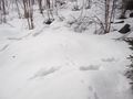
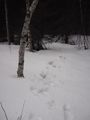
Moose and hare tracks.
Moose manure.
Moose hair.
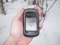
GPS proof: hashpoint reached.
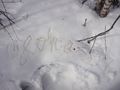
Hashpoint marked in the snow.
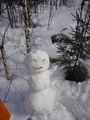
The snowman I built.
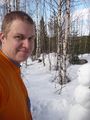
Me at the hashpoint.
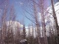
The sky is clearing up.
Snowmobile track back from the hashpoint.
Nicely walkable forest road.
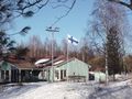
The Finnish flag flying.


Achievements