Difference between revisions of "2019-04-15 50 11"
From Geohashing
imported>Reinhard (photos will be uploaded later) |
imported>FippeBot m (Location) |
||
| Line 29: | Line 29: | ||
[[Category:Expeditions with photos]] | [[Category:Expeditions with photos]] | ||
[[Category:Coordinates reached]] | [[Category:Coordinates reached]] | ||
| + | {{location|DE|TH|AP}} | ||
Latest revision as of 04:39, 16 August 2019
| Mon 15 Apr 2019 in 50,11: 50.9081635, 11.3363404 geohashing.info google osm bing/os kml crox |
Location
In the forest south of Buchfart, Thuringia, Germany.
Participants
Expedition
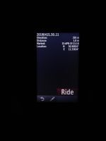
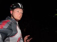
After a warm day it got cold in the evening down to -3°C on Reinhard's ride along well-known roads to Buchfart. Arriving there he had to follow a horrible gravel road into the forest where the hashpoint lay only 10 m beside the road between dense young trees with flexible leafless branches at eye level.
Tracklog
Photos
|

