Difference between revisions of "2019-07-11 51 8"
imported>GeorgDerReisende (new report) |
imported>GeorgDerReisende (expedition report for Arnsberg-Oeventrop) |
||
| Line 1: | Line 1: | ||
| − | |||
| − | |||
| − | |||
| − | |||
| − | |||
| − | |||
| − | |||
| − | |||
| − | |||
| − | |||
{{meetup graticule | {{meetup graticule | ||
| lat=51 | | lat=51 | ||
| Line 19: | Line 9: | ||
== Location == | == Location == | ||
| − | + | ||
| + | The hash lay beside the eastbound track of the railway line Schwerte - Warburg near Oeventrop. | ||
== Participants == | == Participants == | ||
| − | + | ||
| − | + | [[User:GeorgDerReisende|GeorgDerReisende]] | |
== Plans == | == Plans == | ||
| − | + | ||
| + | Traveling by train to Oeventrop. A small walk around Oeventrop. Traveling by train to Freienohl. Traveling by train to Arnsberg. Waling around Arnsberg. Traveling home. Ever I pass the railway line from Oeventrop to Freienohl, I will pass the hash. | ||
== Expedition == | == Expedition == | ||
| − | |||
| − | + | Went everything as planned. Nothing more to tell. No dance in the train. | |
| − | |||
== Photos == | == Photos == | ||
| − | |||
| − | |||
| − | |||
<gallery perrow="5"> | <gallery perrow="5"> | ||
| + | 2019-07-11 51 8 GeorgDerReisende 2709.jpg | arriving at and passing Freienohl in the train | ||
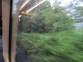
| + | 2019-07-11 51 8 GeorgDerReisende 2710.jpg | passing the hash some seconds before the arrival at Oeventrop | ||
| + | 2019-07-11 51 8 GeorgDerReisende 2711.jpg | arrived at Oeventrop | ||
| + | 2019-07-11 51 8 GeorgDerReisende 2714.jpg | the railway station of Oeventrop with a view to Oeventrop | ||
| + | 2019-07-11 51 8 GeorgDerReisende 2715.jpg | view from the northern end of the platform to the hash, but it lay just behind the curve | ||
| + | 2019-07-11 51 8 GeorgDerReisende 2719.jpg | looking to the west near the hash | ||
| + | 2019-07-11 51 8 GeorgDerReisende 2723.jpg | view from the car parking in the north to the south, but the hash lay just behind the curve | ||
| + | 2019-07-11 51 8 GeorgDerReisende 2773.jpg | starting at Oeventrop | ||
| + | 2019-07-11 51 8 GeorgDerReisende 2775.jpg | best view of the hash | ||
| + | 2019-07-11 51 8 GeorgDerReisende 2777.jpg | the geohasher | ||
</gallery> | </gallery> | ||
| − | + | [[Category:Expeditions]] | |
| − | |||
| − | |||
| − | + | [[Category:Expeditions with photos]] | |
| − | |||
| − | [[Category: | ||
| − | + | [[Category:Expedition without GPS]] | |
| − | |||
| − | |||
| − | |||
| − | |||
| − | |||
| − | |||
| − | |||
| − | |||
| − | |||
| − | |||
| − | |||
| − | |||
| − | |||
| − | |||
| − | |||
| − | |||
[[Category:Coordinates reached]] | [[Category:Coordinates reached]] | ||
| − | |||
| − | |||
| − | |||
| − | |||
| − | |||
| − | |||
| − | |||
| − | |||
| − | |||
| − | |||
| − | |||
| − | |||
| − | |||
| − | |||
| − | |||
| − | |||
| − | |||
| − | |||
Revision as of 07:54, 27 July 2019
| Thu 11 Jul 2019 in 51,8: 51.3948936, 8.1337702 geohashing.info google osm bing/os kml crox |
Location
The hash lay beside the eastbound track of the railway line Schwerte - Warburg near Oeventrop.
Participants
Plans
Traveling by train to Oeventrop. A small walk around Oeventrop. Traveling by train to Freienohl. Traveling by train to Arnsberg. Waling around Arnsberg. Traveling home. Ever I pass the railway line from Oeventrop to Freienohl, I will pass the hash.
Expedition
Went everything as planned. Nothing more to tell. No dance in the train.
Photos
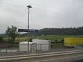
arriving at and passing Freienohl in the train
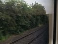
passing the hash some seconds before the arrival at Oeventrop
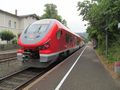
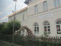
arrived at Oeventrop
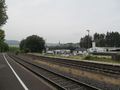
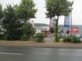
the railway station of Oeventrop with a view to Oeventrop
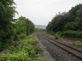
view from the northern end of the platform to the hash, but it lay just behind the curve
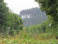
looking to the west near the hash
view from the car parking in the north to the south, but the hash lay just behind the curve
starting at Oeventrop
best view of the hash

the geohasher


