Difference between revisions of "User:Anthony"
From Geohashing
imported>Anthony (→Miscellany: add minesweeper) |
imported>Anthony (→Miscellany: add pictures, add captions) |
||
| Line 34: | Line 34: | ||
<gallery> | <gallery> | ||
| − | + | File:Anthony-2008-06-30-37--122.jpg|2008-06-30, Alameda CA | |
| − | + | File:The Village at Corte Madera.jpg|2008-12-29, Corte Madera, CA | |
| − | + | File:GeohashLocation2009-10-20.jpg|2009-10-20, Livermore, CA, unsuccessful | |
| − | + | File:IMG 5495.JPG|2009-11-25, Oakland, CA | |
| + | File:GeohashLocation2009-12-21.jpg|2009-12-21, Livermore, CA | ||
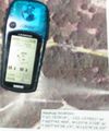
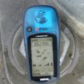
| + | File:GeohashGPS2009-12-21.jpg|2009-12-21, Livermore, CA | ||
</gallery> | </gallery> | ||
Revision as of 00:16, 21 November 2010
I'm Anthony. I live in Alameda, California, which is near San Francisco, California.
I will only intermittently make attempts to reach geohash points.
I think that the one-degree-square boxen should be called "quadrangles", like the USGS has been calling them forever.
Geohash attempts

Anthony and daughter at the 2008-06-30 37 -122 spot
Successful
- 2008-06-30 37 -122 (San Francisco Quadrangle) - this is not the nearest it's ever been to my house, but it's the nearest that's been on dry land. And on a sidewalk by a shopping center - super-convenient. See my flickr photos. KMZ file available here.
- 2008-12-29 37 -122 (San Francisco Quadrangle) - In a shopping mall in Marin County on a short workday.
- 2009-01-09 37 -121 (San José Quadrangle) - In the middle of a rural street just north of Livermore, about 5 miles from my work, on a workday.
- 2009-11-25 37 -122 (San Francisco Quadrangle) - in a turnout on Golf Links Road in the Oakland Hills, reached on a workday night.
- 2009-11-28 37 -122 (San Francisco Quadrangle) - in the Bay Bridge toll plaza on a saturday when I was already planning to cross the bridge.
- 2009-12-21 37 -121 (San José Quadrangle) - in an intersection of major streets in Livermore.
- 2010-04-07 37 -122 (San Francisco Quadrangle) - On arterial street in San Leandro. Drove through hash point twice.
- 2010-11-03 37 -122 (San Francisco Quadrangle) - On arterial street in San Leandro. Drove through hash point at speed.
- 2010-11-10 37 -121 (San José Quadrangle) - on the side of a street behind a shopping center in San Ramon.
Unsuccessful
- I made my first attempt at a geohash on 2008-06-20, but was unable to reach the site, due to lack of trail and unwillingness to attempt cross-country through the poison oak. A Google Earth kmz file of my attempt is available here.
- I drove past the San José location for 2008-06-25 on my way home, but didn't have time to find a good place to park along Stanley Boulevard, or a good way to take pictures of the site and my GPS while whizzing by at 50+ mph.
- I came within 105 m of the San José location for 2009-05-06 during the work day, but didn't go inside.
- I came within 26 m of the San José location for 2009-10-20 during the work day, but didn't go inside.
Miscellany
Anthony earned the Land geohash achievement
|
Anthony earned the Speed racer achievement
|
Anthony achieved level 1 of the Minesweeper Geohash achievement
|


