Difference between revisions of "2008-06-21 55 13"
imported>HannesL (→Meetup #1) |
imported>HannesL (→Meetup #1) |
||
| Line 15: | Line 15: | ||
| − | <gallery caption="Photo Gallery" widths="200px" heights="200px" perrow=" | + | <gallery caption="Photo Gallery" widths="200px" heights="200px" perrow="2"> |
Image:2008-06-21_55_13_1.jpg|The spot, somewhere straight ahead. | Image:2008-06-21_55_13_1.jpg|The spot, somewhere straight ahead. | ||
Image:2008-06-21_55_13_2.jpg|Ernst and Ida. | Image:2008-06-21_55_13_2.jpg|Ernst and Ida. | ||
Revision as of 14:05, 25 June 2008
| Sat 21 Jun 2008 in 55,13: 55.9793177, 13.6139621 geohashing.info google osm bing/os kml crox |
About
This hash in the Malmö, Sweden graticule was located north of Höör. This time in what could be most easily be descibed as a swamp. Due to a very poor choice of shoes we couldn't get to the exact spot, but the first photo is of the general area of the spot.
GPS: (55.979317N, 13.613962E).
Meetup #1
Karl-Anders drove there accompanied by Ernst and Ida.
- Photo Gallery
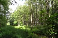
The spot, somewhere straight ahead.

Ernst and Ida.
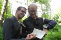
Ernst (again!) and K-A with map and GPS.


Meetup #2
David, HannesL and Therese drove to the spot. Was there about an hour after the first team. The last piece of road looked to narrow for the Geohash-mobile, so we chickened out. Good that someone made an honest attempt to find the exact location. I guess we're to lazy. See you guys the next time!
- Photo Gallery
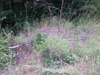
No wheat field this time.
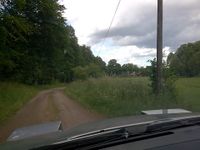
Here we should have made a 160 degree turn left onto a very small gravel road.
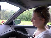
Therese in the shootgun position.


