Difference between revisions of "2020-04-08 51 9"
(expedition report for Kassel-Nordshausen) |
(photos added) |
||
| Line 26: | Line 26: | ||
== Photos == | == Photos == | ||
| + | <gallery> | ||
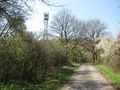
| + | File:2020-04-08 51 9 GeorgDerReisende 7702.jpg | view from the bridge to the hash | ||
| + | File:2020-04-08 51 9 GeorgDerReisende 7733.jpg | view from the Korbacher Straße to the hash | ||
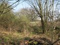
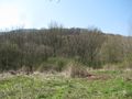
| + | File:2020-04-08 51 9 GeorgDerReisende 7739.jpg | the fieldway along the hash | ||
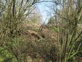
| + | File:2020-04-08 51 9 GeorgDerReisende 7740.jpg | the earth wall | ||
| + | File:2020-04-08 51 9 GeorgDerReisende 7741.jpg | looking back I | ||
| + | File:2020-04-08 51 9 GeorgDerReisende 7742.jpg | looking back II | ||
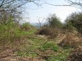
| + | File:2020-04-08 51 9 GeorgDerReisende 7758.jpg | approach from the other side | ||
| + | File:2020-04-08 51 9 GeorgDerReisende 7761.jpg | big dangerous garden dump | ||
| + | File:2020-04-08 51 9 GeorgDerReisende 7763.jpg | the same | ||
| + | File:2020-04-08 51 9 GeorgDerReisende 7766.jpg | the way onto the dump | ||
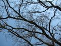
| + | File:2020-04-08 51 9 GeorgDerReisende 7767.jpg | the tree oh hash | ||
| + | File:2020-04-08 51 9 GeorgDerReisende 7768.jpg | the hash under the tree | ||
| + | File:2020-04-08 51 9 GeorgDerReisende 7769.jpg | at the hash looking at the tree | ||
| + | File:2020-04-08 51 9 GeorgDerReisende 7770.jpg | at the hash under the tree | ||
| + | File:2020-04-08 51 9 GeorgDerReisende 7772.jpg | the geohasher | ||
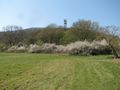
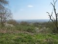
| + | File:2020-04-08 51 9 GeorgDerReisende 7773.jpg | looking north | ||
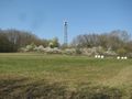
| + | File:2020-04-08 51 9 GeorgDerReisende 7774.jpg | looking northwest | ||
| + | File:2020-04-08 51 9 GeorgDerReisende 7775.jpg | looking west | ||
| + | File:2020-04-08 51 9 GeorgDerReisende 7776.jpg | looking east | ||
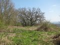
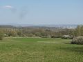
| + | File:2020-04-08 51 9 GeorgDerReisende 7778.jpg | open land, looking north | ||
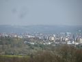
| + | File:2020-04-08 51 9 GeorgDerReisende 7781.jpg | looking home | ||
| + | </gallery> | ||
== Achievements == | == Achievements == | ||
Revision as of 22:01, 8 April 2020
| Wed 8 Apr 2020 in 51,9: 51.2747468, 9.4139282 geohashing.info google osm bing/os kml crox |
Location
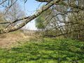
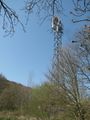
The hash lay near a cell tower at the southwestern border of Kassel.
Participants
Plans
Using public transport and a walk.
Expedition
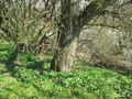
I left home and travelled by tram through the city and with the bus to the outskirts. Then I walked to the hash. But then, as I arrived at the location, I found a steep wall of earth, which hindered me to enter the hash area. And besides the wall there was a deep slope, which hindered me. And I gave it a miss and walked away. But as I wandered around I sometimes had a look back to the place and it didn't look so dangerous. So I walked a big circle across meadows and ditches and narrow footpaths and found an entrance to the area. But the ground didn't look hard, it was just a big deposit of old grass, old branches and old blackcurrent strings, like a big garden dump. But there was a spur of cars and I could walk to the hash. The hash lay under the tree and the tree was buried some meters by the big dump.
Later at home I noticed, that my camera messed up with some dirt fluffs on the sensor and all photos of the area are not useable and the camera anymore.
Photos
view from the bridge to the hash
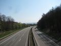
view from the Korbacher Straße to the hash
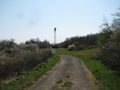
the fieldway along the hash
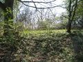
the earth wall
looking back I
looking back II
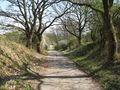
approach from the other side
big dangerous garden dump
the same
the way onto the dump
the tree oh hash
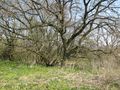
the hash under the tree
at the hash looking at the tree
at the hash under the tree

the geohasher
looking north
looking northwest
looking west
looking east
open land, looking north
looking home


