|
|
| Line 1: |
Line 1: |
| − | <!-- If you did not specify these parameters in the template, please substitute appropriate values for IMAGE, LAT, LON, and DATE (YYYY-MM-DD format)
| + | {{meetup graticule |
| − | | |
| − | [[Image:{{{image|IMAGE}}}|thumb|left]]
| |
| − | | |
| − | Remove this section if you don't want an image at the top (left) of your report. You should remove the "Image:" or "File:"
| |
| − | tag from your image file name, and replace the all upper-case word IMAGE in the above line.
| |
| − | | |
| − | And DON'T FORGET to add your expedition and the best photo you took to the gallery on the Main Page! We'd love to read your report, but that means we first have to discover it! :)
| |
| − | -->{{meetup graticule
| |
| | | lat=43 | | | lat=43 |
| | | lon=-115 | | | lon=-115 |
| | | date=2020-05-01 | | | date=2020-05-01 |
| − | }}<!-- edit as necessary --> | + | }} |
| | __NOTOC__ | | __NOTOC__ |
| | == Location == | | == Location == |
| Line 17: |
Line 9: |
| | | | |
| | == Participants == | | == Participants == |
| − | <!-- who attended: If you link to your wiki user name in this section, your expedition will be picked up by the various statistics generated for geohashing. You may use three tildes ~ as a shortcut to automatically insert the user signature of the account you are editing with.
| + | [[User:Penguins|Penguins]], a few family members, and a small dog |
| − | -->
| |
| | | | |
| | == Plans == | | == Plans == |
| Line 42: |
Line 33: |
| | Following the trail led us to the track road I had seen on the map, and from there we reached the hashpoint. | | Following the trail led us to the track road I had seen on the map, and from there we reached the hashpoint. |
| | | | |
| − | == Tracklog ==
| |
| − | <!-- if your GPS device keeps a log, you may post a link here -->
| |
| − |
| |
| − | == Photos ==
| |
| − | <!-- Insert pictures between the gallery tags using the following format:
| |
| − | Image:2020-##-## ## ## Alpha.jpg | Witty Comment
| |
| − | -->
| |
| − | <gallery perrow="5">
| |
| − | </gallery>
| |
| − |
| |
| − | == Achievements ==
| |
| − | {{#vardefine:ribbonwidth|800px}}
| |
| − | <!-- Add any achievement ribbons you earned below, or remove this section -->
| |
| − |
| |
| − | <!-- =============== USEFUL CATEGORIES FOLLOW ================
| |
| − | Delete the next line ONLY if you have chosen the appropriate categories below. If you are unsure, don't worry. People will read your report and help you with the classification. -->
| |
| | [[Category:New report]] | | [[Category:New report]] |
| | | | |
| − | <!-- ==REQUEST FOR TWITTER BOT== Please leave either the New report or the Expedition planning category in as long as you work on it. This helps the twitter bot a lot with announcing the right outcome at the right moment. -->
| |
| − |
| |
| − | <!-- Potential categories. Please include all the ones appropriate to your expedition -->
| |
| − | <!-- If this is a planning page:
| |
| − | [[Category:Expedition planning]]
| |
| − | -->
| |
| − |
| |
| − | <!-- If all those plans are never acted upon, change [[Category:Expedition planning]] to [[Category:Not reached - Did not attempt]]. -->
| |
| − |
| |
| − | <!-- An actual expedition:
| |
| | [[Category:Expeditions]] | | [[Category:Expeditions]] |
| − | -- and one or more of --
| |
| | [[Category:Expeditions with photos]] | | [[Category:Expeditions with photos]] |
| − | [[Category:Expeditions with videos]]
| |
| − | [[Category:Expedition without GPS]]
| |
| − | -->
| |
| − |
| |
| − | <!-- if you reached your coords:
| |
| | [[Category:Coordinates reached]] | | [[Category:Coordinates reached]] |
| − |
| |
| − |
| |
| − | --><!-- or if you failed :(
| |
| − | [[Category:Coordinates not reached]]
| |
| − | -- and a reason --
| |
| − | When there is a natural obstacle between you and the target:
| |
| − | [[Category:Not reached - Mother Nature]]
| |
| − |
| |
| − | When there is a man-made obstacle between you and the target:
| |
| − | [[Category:Not reached - No public access]]
| |
| − |
| |
| − | When you failed get your GPS, car, bike or such to work:
| |
| − | [[Category:Not reached - Technology]]
| |
| − |
| |
| − | When you went to an alternate location instead of the actual geohash:
| |
| − | [[Category:Not reached - Attended alternate location]]
| |
| − |
| |
| − | (Don't forget to delete this final close comment marker) -->
| |
Location
Between Robie Creek and Highway 21. OSM shows a highway=track leading almost to the point
Participants
Penguins, a few family members, and a small dog
Plans
I believe we can park at the boat ramp in the park. From there it should be possible to walk to the hashpoint. Maybe.
Expedition
We drove over and found a parking spot across the road from the boat dock area, which appeared to be closed. All the bathrooms nearby were also locked, so some of us made do with the mountain.
We decided to follow the road across the creek and work out from there how to get to the point.
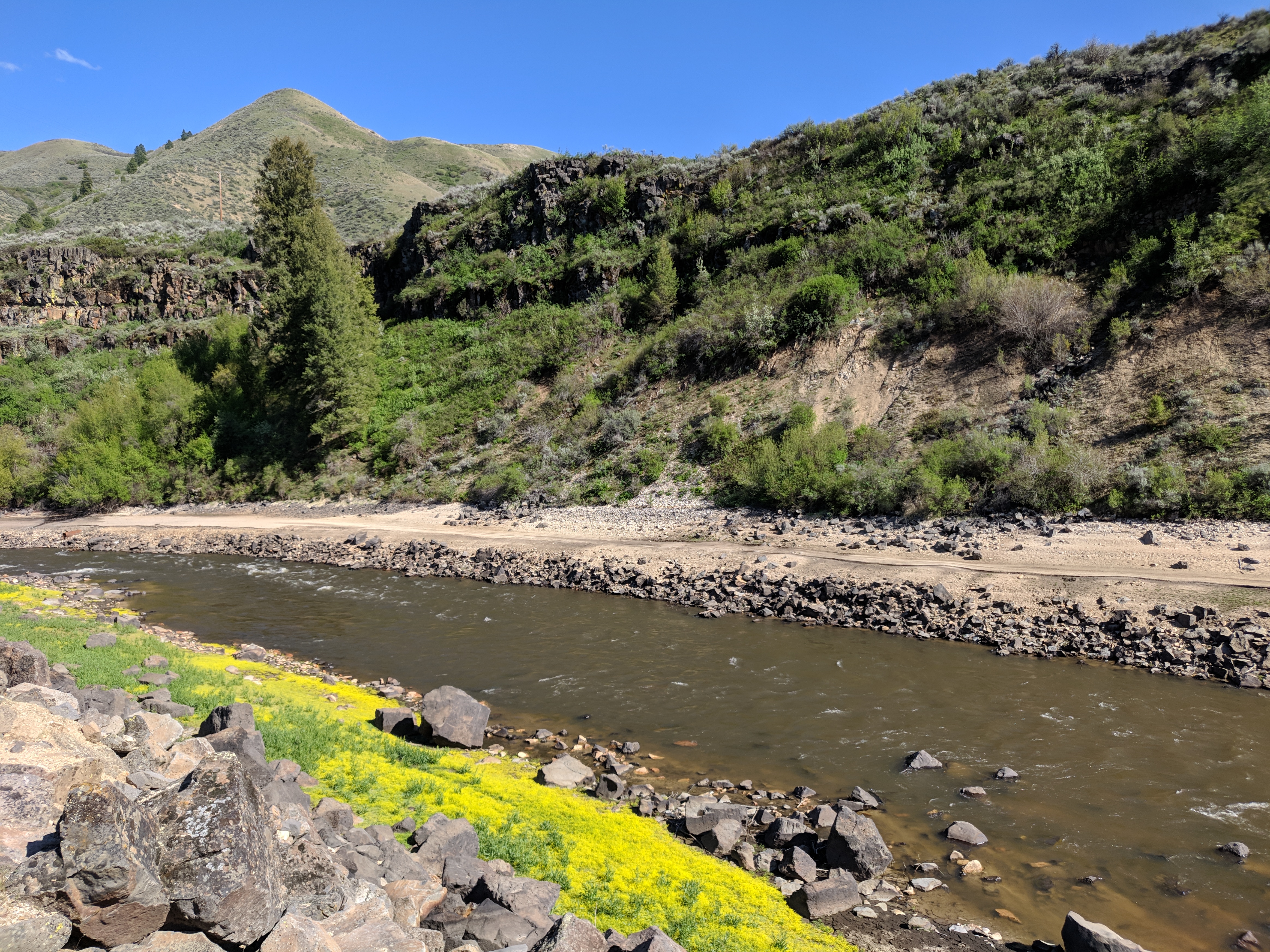
That's a bit of a climb
Ah. Looking at aerial views had not prepared us for the elevation change required.
We crossed the bridge and found a dirt road on the other side of the creek. We walked back along it until we came to a spot that looked possibly climbable, and...
Well, it's still a steep mountain. Halfway up, we began to doubt whether we would make it, but also weren't so sure about turning around and going back down. One party member proceeded upward and out of sight. Shortly, he returned and confirmed that he had reached the top, so it was possible. We slowly made our way up to follow him, and eventually all made it to what appeared to be a trail.
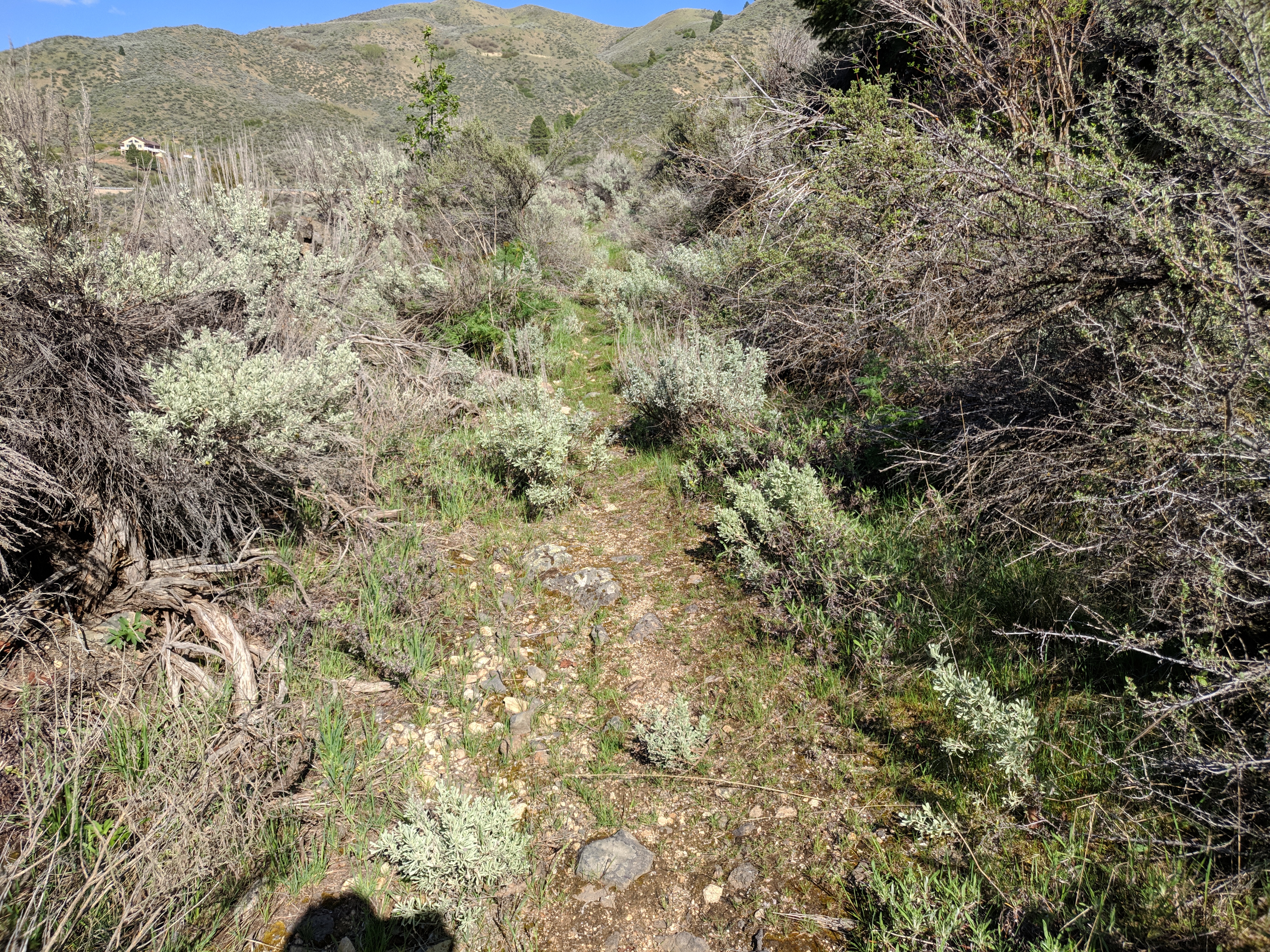
A welcome sight.
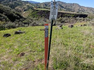
More of a point than the real one
Following the trail led us to the track road I had seen on the map, and from there we reached the hashpoint.


