Difference between revisions of "File:2009-05-11 39 -88 1201 Where I Was Going.PNG"
From Geohashing
(Maintenance script uploaded File:2009-05-11 39 -88 1201 Where I Was Going.PNG) |
m (Replacing Category:GPS receivers with Category:GNSS receivers) |
||
| Line 1: | Line 1: | ||
When you Google directions, they always take you to the nearest point on a road to the hash. This is a problem if there's a lake in between. | When you Google directions, they always take you to the nearest point on a road to the hash. This is a problem if there's a lake in between. | ||
[[Category: Meetup on 2009-05-11]] | [[Category: Meetup on 2009-05-11]] | ||
| − | [[Category: Meetup in 39 -88]][[Category: | + | [[Category: Meetup in 39 -88]][[Category:GNSS receivers]] |
Latest revision as of 19:24, 21 September 2020
When you Google directions, they always take you to the nearest point on a road to the hash. This is a problem if there's a lake in between.
File history
Click on a date/time to view the file as it appeared at that time.
| Date/Time | Thumbnail | Dimensions | User | Comment | |
|---|---|---|---|---|---|
| current | 15:27, 30 January 2020 | 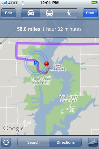 | 320 × 480 (83 KB) | Maintenance script (talk | contribs) |
- You cannot overwrite this file.
File usage
The following page links to this file: