Difference between revisions of "2021-02-14 60 21"
From Geohashing
(→Photos) |
|||
| Line 1: | Line 1: | ||
| − | |||
| − | |||
| − | + | [[Image:{{{image|photo_2021-02-14_14-43-57.jpg}}}|thumb|left]] | |
| − | |||
| − | + | {{meetup graticule | |
| − | |||
| lat={{#explode:{{SUBPAGENAME}}| |1}} | | lat={{#explode:{{SUBPAGENAME}}| |1}} | ||
| lon={{#explode:{{SUBPAGENAME}}| |2}} | | lon={{#explode:{{SUBPAGENAME}}| |2}} | ||
Revision as of 12:48, 14 February 2021
| Sun 14 Feb 2021 in 60,21: 60.7947251, 21.6760377 geohashing.info google osm bing/os kml crox |
Location
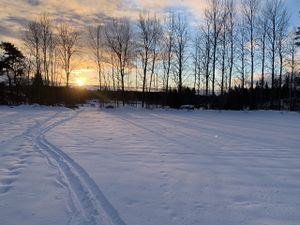
Field edge next to private home.
Participants
Plans
Hike there with sliding snowshoes through fields and forests.
Expedition
As planned, about 5km. No roads used.


