Difference between revisions of "2013-11-10 28 -82"
imported>FippeBot m (Location) |
m |
||
| Line 15: | Line 15: | ||
=== The Geohashers === | === The Geohashers === | ||
| − | * [[user: | + | * [[user:Geoffistopheles|Geoff]] |
* Geoff's Mom | * Geoff's Mom | ||
* [[user:NinjaBait|Erica]] | * [[user:NinjaBait|Erica]] | ||
Latest revision as of 17:10, 24 March 2021
| Have you seen our geohashing marker? We'd love to hear from you! Click here to say "hi" and tell us what you've seen!
Curious about what geohashing is? Read more! |
| Sun 10 Nov 2013 in Honeymoon Island, Florida: 28.0623886, -82.8278696 geohashing.info google osm bing/os kml crox |
Expedition
The Plan
Just off Causeway Blvd on Honeymoon Island. Parents have an annual pass, so we're hoping to invite everyone we can into this one.
The Geohashers
- Geoff
- Geoff's Mom
- Erica
- Pope Flactem I
The Adventure
Why is it that every time we come back this way, there's an accessible hash?
It's really not far from us, but due to Erica's ear infection, biking wasn't much of an option. Instead, we all got into the car and drove down. Mom decided to come to one to see what was going on, and everyone else we invited had other things they were doing.
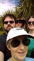
Aside from that, it wasn't very eventful. We parked and walked back to the road, took an accurate picture, and then nodded in agreement when the GPS refused to work from there. Still, we got some pictures out of it. Afterwards, we left the Two of Hearts by the beach, Mom stayed there, and the remaining three went on a nature trail to see bald eagles. Osprey, yes. Bald eagle, all we got was a nest. Still, success!
Gallery
- Photo Gallery

