Difference between revisions of "2008-07-08 55 12"
imported>J0e m |
imported>J0e m |
||
| Line 29: | Line 29: | ||
---- | ---- | ||
| − | I doubt if that GPS unit would have made much difference, since mine went crazy as soon as I entered the 30 m perimeter, but it ''is'' old and dull (like some geohashers). I managed to narrow it further down to about half of that, but the best I could do was "somewhere on this side of that hill", besides I'm a decimal short (big deal with that drift). Missed the swing | + | I doubt if that GPS unit would have made much difference, since mine went crazy as soon as I entered the 30 m perimeter, but it ''is'' old and dull (like some geohashers). I managed to narrow it further down to about half of that, but the best I could do was "somewhere on this side of that hill", besides I'm a decimal short (big deal with that drift). Missed the swing. --[[User:J0e|j0e]] 00:57, 9 July 2008 (UTC) |
== The Pictures == | == The Pictures == | ||
Revision as of 01:08, 9 July 2008
| Tue 8 Jul 2008 in Copenhagen: 55.8055027, 12.5224928 geohashing.info google osm bing/os kml crox |
Hash: 55.805502, 12.522492
Closest town: Nærum
Surroundings: Forest
Navigation: Google Earth, Garmin etrex GPS
Participants: J0e, (bjuhn)
The geohash for 2008-07-08 55 12 was located in Ravneholm Forest near Mølleåen (Mill River) :)
The weather was dominated by showers most of the day, but with the aid of the weather layer on Google Earth and the radar imagery from DMI I managed to avoid the worst downpour, and I only got a little wet.
The old Garmin, I borrowed (affectionately known as "Old Yeller") turned out to be less than adequate for the job. Whether it was the GPS receiver itself or the canope above that was playing tricks on me, I cannot tell. At one point I had a reading saying 2m to hash, so I put the GPS receiver on the ground in order to take a picture, only to watch the reading drift 20-30 m . Bummer :P
Regardless, I'm posting this as a reached geohash, since I spent about an hour walking all over the same 600 m2 over and over, so I have been there, I just can't say exactly when. The marker may therefore be placed as much as the before mentioned 20-30 m off.
bjuhn tried reaching the mark a little before midnight but failed... primarily because of his dear mom lending out the goddamned gps-unit -_-
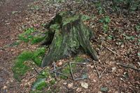
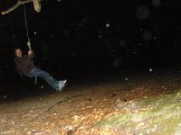
I wandered around the area in the rain for half an hour before giving up on finding the tree stump... oh, i found a nice swing:
I doubt if that GPS unit would have made much difference, since mine went crazy as soon as I entered the 30 m perimeter, but it is old and dull (like some geohashers). I managed to narrow it further down to about half of that, but the best I could do was "somewhere on this side of that hill", besides I'm a decimal short (big deal with that drift). Missed the swing. --j0e 00:57, 9 July 2008 (UTC)

