Difference between revisions of "2023-02-10 53 -2"
From Geohashing
([live picture]Me at the hash :) [https://openstreetmap.org/?mlat=53.59150400&mlon=-2.67215600&zoom=16 @53.5915,-2.6722]) |
(Categories, location, participant) |
||
| Line 14: | Line 14: | ||
== Location == | == Location == | ||
<!-- where you've surveyed the hash to be --> | <!-- where you've surveyed the hash to be --> | ||
| + | This Geohash is located on a path in Standish. | ||
== Participants == | == Participants == | ||
<!-- who attended: If you link to your wiki user name in this section, your expedition will be picked up by the various statistics generated for geohashing. You may use three tildes ~ as a shortcut to automatically insert the user signature of the account you are editing with. | <!-- who attended: If you link to your wiki user name in this section, your expedition will be picked up by the various statistics generated for geohashing. You may use three tildes ~ as a shortcut to automatically insert the user signature of the account you are editing with. | ||
--> | --> | ||
| + | *[[User:Angel|Angel]] | ||
== Plans == | == Plans == | ||
| Line 42: | Line 44: | ||
__NOTOC__ | __NOTOC__ | ||
| − | |||
| − | |||
| − | |||
| − | |||
| − | |||
| − | |||
| − | |||
| − | |||
| − | |||
| − | |||
| − | |||
| − | |||
| − | |||
| − | |||
[[Category:Expeditions]] | [[Category:Expeditions]] | ||
| − | |||
[[Category:Expeditions with photos]] | [[Category:Expeditions with photos]] | ||
| − | |||
| − | |||
| − | |||
| − | |||
| − | |||
[[Category:Coordinates reached]] | [[Category:Coordinates reached]] | ||
| − | |||
| − | |||
| − | |||
| − | |||
| − | |||
| − | |||
| − | |||
| − | |||
| − | |||
| − | |||
| − | |||
| − | |||
| − | |||
| − | |||
| − | |||
| − | |||
| − | |||
| − | |||
Revision as of 16:27, 7 March 2023
| Fri 10 Feb 2023 in 53,-2: 53.5915020, -2.6721512 geohashing.info google osm bing/os kml crox |
Location
This Geohash is located on a path in Standish.
Participants
Plans
Expedition
Tracklog
Photos
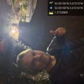
Me at the hash :) @53.5915,-2.6722
