Difference between revisions of "2023-07-18 58 5"
From Geohashing
(→Location) |
(→Photos) |
||
| Line 39: | Line 39: | ||
Image:2023-07-18_58_5_Pica42_1689679199825.jpg|Alsvik [https://openstreetmap.org/?mlat=58.86338840&mlon=5.87658500&zoom=16 @58.8634,5.8766] | Image:2023-07-18_58_5_Pica42_1689679199825.jpg|Alsvik [https://openstreetmap.org/?mlat=58.86338840&mlon=5.87658500&zoom=16 @58.8634,5.8766] | ||
| + | Image:20230718 58 5 03.jpg|thumb|Photo from the trail | ||
| + | |||
| + | |||
| + | |||
| + | |||
| + | |||
| + | |||
| + | |||
</gallery> | </gallery> | ||
Revision as of 16:43, 18 July 2023
| Tue 18 Jul 2023 in 58,5: 58.8633826, 5.8765444 geohashing.info google osm bing/os kml crox |
Location
Near Dormelinuten in Sandnes municipality
Participants
Plans
Expedition
Tracklog
Photos

Alsvik @58.8634,5.8766
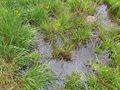
Photo from the trail


Achievements