Difference between revisions of "2019-05-05 50 12"
imported>FippeBot m (Location) |
(→tracklog) |
||
| Line 44: | Line 44: | ||
===tracklog=== | ===tracklog=== | ||
| − | + | {{tracklog | 2019-05-05 50 12-triton.gpx}} | |
[[Category:Expeditions]] | [[Category:Expeditions]] | ||
Latest revision as of 11:27, 17 August 2023
| Sun 5 May 2019 in Chemnitz: 50.7018974, 12.9180754 geohashing.info google osm bing/os kml crox |
Location
Today's location is in the Abtwald forest between Gelenau, Burkhardtsdorf and Auerbach.
Country: Germany; state: Sachsen (Saxony, EU:DE:SN); district: Erzgebirgskreis; municipality: Gelenau/Erzgeb.
Weather: cloudy with a bit of sun, fresh (probably around 5°C
Expedition
Danatar
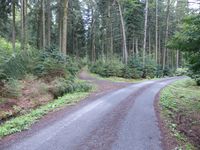
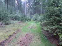
I was on my way back from Würzburg and I had planned to visit the hashpoint. On Friday I had already planned a route that would take as few additional kilometers as possible compared to the quick route along the Autobahn, it would lead me through the Erzgebirge mountain range. I was in no hurry and managed to drive even more fuel-efficiently as usual (it was 15 % less than usual according to the display when I reached Dresden). At the Stollberg West exit I left the Autobahn and followed the federal road for a bit. Then at Brünlos the smaller roads started, going from small village to small village. Via Dorfchemnitz and Hormersdorf I had a very nice drive along fields, over hills and through picturesque villages. The sunshine made the rapeseed fields glow golden, a very nice contrast to the darker clouds. Finally I reached Gelenau and parked the car at the town limit, next to a commercial zone. From there I started walking into the forest along a tarmacked road. I passed two people while walking, the rest of the time I was alone. After a while I came to a larger dirt track and followed that for a while until I was on smaller dirt tracks. Without sun it was rather cold between the trees. After climbing over fallen trees and walking around muddy puddles for a while I finally came near the hashpoint. The GPS dance was a bit complicated but I finally reached the spot (and in this case, "spot" means quite a large area, around 10x10 m).
After a little happy celebration I started to build a marker. There were lots of fir cones lying around so I used those. When I had finished everything I walked back towards my car. I was surprised that all the walking to and being at the hashpoint had taken 80 minutes. Then I continued my journey through the erzgebirgian countryside. Again there were many small villages as I drove via Gornau, Grünhainichen and Eppendorf to Freiberg. From there I could use the larger B173 federal road to Dresden. In total the drive took 1.25 hours longer than usual but due to the route I took it were only 11 additional kilometers, I also walked 3.6 km.
|
tracklog


