Difference between revisions of "2023-09-22 52 7"
From Geohashing
(new report) |
(+OSM) |
||
| Line 27: | Line 27: | ||
{{#vardefine:ribbonwidth|100%}} | {{#vardefine:ribbonwidth|100%}} | ||
{{land geohash|date=2023-09-22|latitude=52|longitude=7|name=[[User:Fippe|Fippe]]|image=2023-09-22 52 7 03 Geohash.jpg}} | {{land geohash|date=2023-09-22|latitude=52|longitude=7|name=[[User:Fippe|Fippe]]|image=2023-09-22 52 7 03 Geohash.jpg}} | ||
| + | {{OSM|date=2023-09-22|latitude=52|longitude=7|name=[[User:Fippe|Fippe]]|OSMlink=141647769}} | ||
{{consecutive geohash 3|date=2023-08-31|latitude=52|longitude=7|daycount=23|hashcount=27|name=[[User:Fippe|Fippe]]}} | {{consecutive geohash 3|date=2023-08-31|latitude=52|longitude=7|daycount=23|hashcount=27|name=[[User:Fippe|Fippe]]}} | ||
Latest revision as of 14:30, 23 September 2023
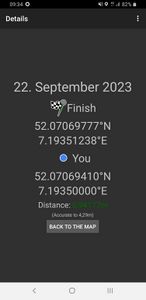
| Fri 22 Sep 2023 in 52,7: 52.0706978, 7.1935124 geohashing.info google osm bing/os kml crox |
Location
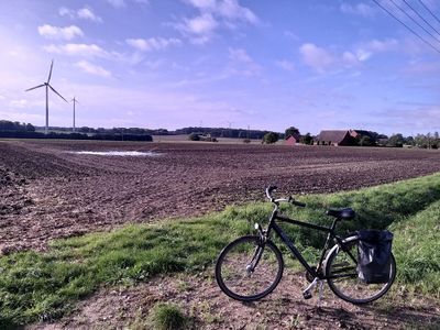
This Geohash is located on a field in Schöppingen.
Participants
Expedition
In the morning, I cycled to Osnabrück Central and took the train via Münster to Lutum and cycled the rest of the distance.
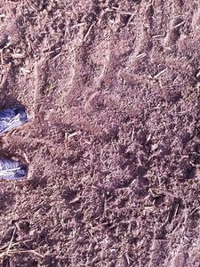
The coordinates were on a seemingly empty field. I was not sure if new plants had already been sowed, so to be sure I walked to the coordinates in the tractor tracks rather than taking the direct path.
After recording proof and walking back to my bike, I cycled to Metelen, took the train via Münster to Osnabrück Central and cycled back home.
Photos
Tracklog
Ribbons
Fippe earned the Land geohash achievement
|
Fippe earned the OpenStreetMap achievement
|
Fippe earned the Consecutive geohash achievement
|


