Difference between revisions of "2023-10-30 49 11"
([live picture]Proof) |
|||
| Line 14: | Line 14: | ||
== Location == | == Location == | ||
<!-- where you've surveyed the hash to be --> | <!-- where you've surveyed the hash to be --> | ||
| + | In the "Lorenzer Reichswald" near Fischbach. | ||
== Participants == | == Participants == | ||
<!-- who attended: If you link to your wiki user name in this section, your expedition will be picked up by the various statistics generated for geohashing. You may use three tildes ~ as a shortcut to automatically insert the user signature of the account you are editing with. | <!-- who attended: If you link to your wiki user name in this section, your expedition will be picked up by the various statistics generated for geohashing. You may use three tildes ~ as a shortcut to automatically insert the user signature of the account you are editing with. | ||
--> | --> | ||
| − | + | [[User:Torodeas|Torodeas]] ([[User talk:Torodeas|talk]]) | |
| − | |||
| − | |||
== Expedition == | == Expedition == | ||
<!-- how it all turned out. your narrative goes here. --> | <!-- how it all turned out. your narrative goes here. --> | ||
| + | |||
| + | This was exactly the kind of hash I like: hidden in a forest, increasing the chance of a successful expedition, | ||
| + | but still reachable by public transport. This time, my final bus stop has the great name "Bärenbühlgraben", | ||
| + | and the hash is less than 1 km from there. | ||
| + | |||
| + | I decided to start this trip after work, and | ||
| + | this time, I arrived as planned around 16:50. | ||
| + | |||
| + | With winter approaching and the end of summer time last weekend, | ||
| + | it is much darker at 5 pm than I expected. But I enjoy walking in low lighting conditions, | ||
| + | so I enter the forest to start approaching the hash. | ||
| + | |||
| + | However, I usually primarily rely on a good night-vision | ||
| + | for hikes in low lighting conditions. | ||
| + | Just using my regular eyes - without any artificial light sources - allows me | ||
| + | to detect general shapes and movements in any direction, not just the one direction my flashlight happens to point. | ||
| + | It's what makes these trips fun. | ||
| + | |||
| + | But this is incompatible with geohashing in at least two aspects: | ||
| + | First, my eyes won't adapt to night vision while I'm looking at my artificially lit screen, | ||
| + | but I need the screen to navigate in unknown places and to locate the hash itself. | ||
| + | And second, my trip towards a hash tends to leave the well prepared paths behind once I'm decently close, | ||
| + | as most hashes are not itself located on any paths. | ||
| + | But walks during low lighting conditions rely on me being able to generally follow a pre-cleared path, | ||
| + | not having to see all details of where I put my feet. | ||
| + | |||
| + | Initially, this isn't a big deal. Even though I cannot clearly see my path, as my eyes constantly have to adjust between the unlit forest and the lit screen, | ||
| + | I manage to arrive at the hash without issues. After a short dance, I get a good reading and record proof (no view from hash because all photos at this point require enabling flash, and I don't see a point trying to light up such a scene). I forget to disable my GPS-tracking and try to head back south towards civilization. | ||
| + | |||
| + | However, I am quite a bit away from any path right now. And now it's so dark that I cannot see the ground well enough to continue my walk like this. | ||
| + | I do have a flashlight with me, but I hate being restricted to only see the parts I currently shine my flashlight on. | ||
| + | But there's no choice: It's either that or staying right where I am. So I grudgingly take my flashlight, and navigate back to Fischbach. | ||
| + | |||
| + | Considering that Fischbach was quite close to my place of work, this is probably my last expedition on a work day for 2023. It's just getting too dark too quickly. At least for the hashes hidden in a forest. | ||
| + | |||
== Tracklog == | == Tracklog == | ||
| Line 43: | Line 77: | ||
== Achievements == | == Achievements == | ||
{{#vardefine:ribbonwidth|100%}} | {{#vardefine:ribbonwidth|100%}} | ||
| − | + | {{land geohash | |
| + | | latitude = 49 | ||
| + | | longitude = 11 | ||
| + | | date = 2023-10-30 | ||
| + | | name = [[User:Torodeas|Torodeas]] ([[User talk:Torodeas|talk]]) | ||
| + | }} | ||
| + | {{Public transport geohash | ||
| + | | latitude = 49 | ||
| + | | longitude =11 | ||
| + | | date = 2023-10-30 | ||
| + | | name = [[User:Torodeas|Torodeas]] ([[User talk:Torodeas|talk]]) | ||
| + | | busline = 280, S1, S2, 56 | ||
| + | }} | ||
| + | __NOTOC__ | ||
| + | [[Category:Expeditions]] | ||
| + | [[Category:Expeditions with photos]] | ||
| + | [[Category:Coordinates reached]] | ||
| + | |||
| − | |||
<!-- =============== USEFUL CATEGORIES FOLLOW ================ | <!-- =============== USEFUL CATEGORIES FOLLOW ================ | ||
Delete the next line ONLY if you have chosen the appropriate categories below. If you are unsure, don't worry. People will read your report and help you with the classification. --> | Delete the next line ONLY if you have chosen the appropriate categories below. If you are unsure, don't worry. People will read your report and help you with the classification. --> | ||
| − | |||
<!-- ==REQUEST FOR TWITTER BOT== Please leave either the New report or the Expedition planning category in as long as you work on it. This helps the twitter bot a lot with announcing the right outcome at the right moment. --> | <!-- ==REQUEST FOR TWITTER BOT== Please leave either the New report or the Expedition planning category in as long as you work on it. This helps the twitter bot a lot with announcing the right outcome at the right moment. --> | ||
Revision as of 18:09, 30 October 2023
| Mon 30 Oct 2023 in 49,11: 49.4346084, 11.1984728 geohashing.info google osm bing/os kml crox |
Location
In the "Lorenzer Reichswald" near Fischbach.
Participants
Expedition
This was exactly the kind of hash I like: hidden in a forest, increasing the chance of a successful expedition, but still reachable by public transport. This time, my final bus stop has the great name "Bärenbühlgraben", and the hash is less than 1 km from there.
I decided to start this trip after work, and this time, I arrived as planned around 16:50.
With winter approaching and the end of summer time last weekend, it is much darker at 5 pm than I expected. But I enjoy walking in low lighting conditions, so I enter the forest to start approaching the hash.
However, I usually primarily rely on a good night-vision for hikes in low lighting conditions. Just using my regular eyes - without any artificial light sources - allows me to detect general shapes and movements in any direction, not just the one direction my flashlight happens to point. It's what makes these trips fun.
But this is incompatible with geohashing in at least two aspects: First, my eyes won't adapt to night vision while I'm looking at my artificially lit screen, but I need the screen to navigate in unknown places and to locate the hash itself. And second, my trip towards a hash tends to leave the well prepared paths behind once I'm decently close, as most hashes are not itself located on any paths. But walks during low lighting conditions rely on me being able to generally follow a pre-cleared path, not having to see all details of where I put my feet.
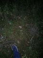
Initially, this isn't a big deal. Even though I cannot clearly see my path, as my eyes constantly have to adjust between the unlit forest and the lit screen, I manage to arrive at the hash without issues. After a short dance, I get a good reading and record proof (no view from hash because all photos at this point require enabling flash, and I don't see a point trying to light up such a scene). I forget to disable my GPS-tracking and try to head back south towards civilization.
However, I am quite a bit away from any path right now. And now it's so dark that I cannot see the ground well enough to continue my walk like this. I do have a flashlight with me, but I hate being restricted to only see the parts I currently shine my flashlight on. But there's no choice: It's either that or staying right where I am. So I grudgingly take my flashlight, and navigate back to Fischbach.
Considering that Fischbach was quite close to my place of work, this is probably my last expedition on a work day for 2023. It's just getting too dark too quickly. At least for the hashes hidden in a forest.
Tracklog
Photos

Bärenbühlgraben bus stop
At the hash

Proof


Achievements
Torodeas (talk) earned the Land geohash achievement
|
Torodeas (talk) earned the Public transport geohash achievement
|