Difference between revisions of "2023-12-07 52 8"
From Geohashing
(new report) |
(last man standing) |
||
| Line 27: | Line 27: | ||
{{#vardefine:ribbonwidth|100%}} | {{#vardefine:ribbonwidth|100%}} | ||
{{land geohash|date=2023-12-07|latitude=52|longitude=8|name=[[User:Fippe|Fippe]]|image=2023-12-07 52 8 02 Geohash.jpg}} | {{land geohash|date=2023-12-07|latitude=52|longitude=8|name=[[User:Fippe|Fippe]]|image=2023-12-07 52 8 02 Geohash.jpg}} | ||
| + | {{last man standing|date=2023-12-07|latitude=52|longitude=8|name=[[User:Fippe|Fippe]]}} | ||
__NOTOC__ | __NOTOC__ | ||
Latest revision as of 01:51, 18 March 2024
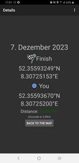
| Thu 7 Dec 2023 in 52,8: 52.3559325, 8.3072515 geohashing.info google osm bing/os kml crox |
Location
This Geohash is located on a meadow in Bohmte.
Participants
Expedition
In the afternoon, I cycled to Osnabrück Central and took the train to Bohmte.
In Bohmte, I walked the short rest of the distance. I left the streets and followed a grassy path behind some houses, past a paddock, and to the meadow, my destination. There, I located the coordinates and recorded proof.
Afterwards, I continued walking the grassy path, which eventually ended up in someone's back yard, which was not what I had mind. I promptly left the yard, hopefully without disturbing anyone, and was back on a regular street. After walking back to the train station, I took the train to Osnabrück Central and cycled back home.
Photos
Proof
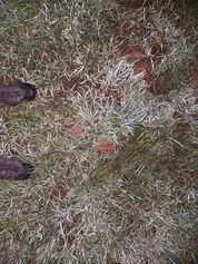
The Geohash
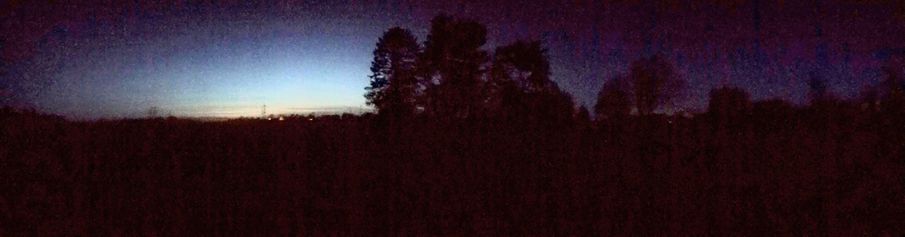
Surroundings
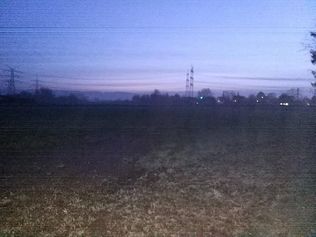
The site of the Geohash


Tracklog
Ribbons
Fippe earned the Land geohash achievement
|
Fippe earned the Last man standing achievement
|