Difference between revisions of "2024-07-29 58 5"
From Geohashing
(→Photos) |
(→Photos) |
||
| Line 41: | Line 41: | ||
Image:2024-07-29_58_5_Pica42_1722241596247.jpg|Sandnes [https://openstreetmap.org/?mlat=58.85084610&mlon=5.75882820&zoom=16 @58.8508,5.7588] | Image:2024-07-29_58_5_Pica42_1722241596247.jpg|Sandnes [https://openstreetmap.org/?mlat=58.85084610&mlon=5.75882820&zoom=16 @58.8508,5.7588] | ||
Image:20240729 58 5 NW.jpg|thumb|View to the northwest | Image:20240729 58 5 NW.jpg|thumb|View to the northwest | ||
| − | + | Image:20240729 58 5 SW.jpg|thumb|View to the southwest | |
Revision as of 15:27, 29 July 2024
| Mon 29 Jul 2024 in 58,5: 58.8508491, 5.7588332 geohashing.info google osm bing/os kml crox |

Location
On the mountain Skjeraberget in the Hana district, Sandnes, Norway
Participants
- Pica42
- pica42's wife
Plans
Expedition
Tracklog
Photos

Sandnes @58.8509,5.7588

Sandnes @58.8508,5.7588
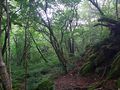
View to the northwest
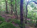
View to the southwest


Achievements