2015-08-07 50 11
From Geohashing
Revision as of 04:43, 15 August 2019 by imported>FippeBot (Location)
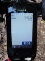
| Fri 7 Aug 2015 in 50,11: 50.5252822, 11.2376178 geohashing.info google osm bing/os kml crox |
Location
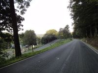
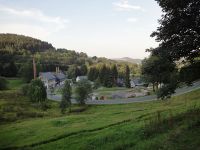
On the road between Lippelsdorf and Schmiedefeld, Thuringia, Germany.
Participants
Expedition
Reinhard started his weekend with a bike ride from Jena to his family in the Thuringian forest. It's only over 90 km taking the shortest route, but as weather was perfect (dry and hot (between 35 and 25°C in the evening)) he enjoyed a detour of 30 km making it a 124 km ride using roads he doesn't take so often (or even never before) and visiting the hashpoint which was located right to the side of the road.
Tracklog
Photos
|


