2017-10-09 47 -122
From Geohashing
Revision as of 00:39, 10 October 2017 by imported>Thomcat ([live picture]Hashers [http://www.openstreetmap.org/?lat=47.67733590&lon=-122.25081020&zoom=16&layers=B000FTF @47.6773,-122.2508])
| Mon 9 Oct 2017 in 47,-122: 47.6773043, -122.2508183 geohashing.info google osm bing/os kml crox |
Location
Participants
Plans
Expedition
Tracklog
Photos
lake wa @47.6771,-122.2508
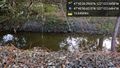
Stream @47.6774,-122.2507

Self @47.6774,-122.2507
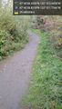
Path @47.6775,-122.2505
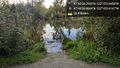
Pond @47.6775,-122.2501
Trees @47.6771,-122.2507

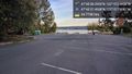
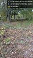
Hashers @47.6773,-122.2508


Achievements