2008-07-21 49 -123
| Mon 21 Jul 2008 in 49,-123: 49.0414124, -123.0382160 geohashing.info google osm bing/os kml crox |
This was Robyn's second attempt at a hash in her home graticule, speaking to how challenging the Vancouver graticule really is. It should have been successful, I thwarted myself.
The Location
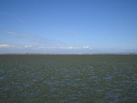
On the map, the Vancouver geohash for Monday, 21st July, 2008 appears to be over a kilometre offshore in Boundary Bay, at Delta, BC. In reality, the 'shore' in that area is a mud flat that would require perhaps five kilometres of walking to reach neck deep water. Being Monday, there was no official meetup time, so I went with low tide, around 2:30 p.m.
The Trip
I decided to make this a public transit achievement, as the most direct route requires passage through a tunnel where bicycles are prohibited, and it would have been a pretty long ride, too. At 12:28, I caught the 22 Macdonald bus to Pender and Howe, transferred there to the 601 South Delta, then transferred at the Ladner Loop to the C76 Scottsdale Exchange, arriving at 64th and Ladner Trunk Road at 14:08. The GPS showed that the hashpoint was 5.4 km to the south, pretty much straight down 64th.
About three and a half kilometres of that was on the road, with the last two kilometres being across the beach. I literally didn't know if this would be a land hash or a water hash. I crossed the dyke, climbed over the pile of weathered logs at the high tide line and walked through a field of some kind of succulent sea grass. With about a kilometre to go, I reached the beach proper. There I changed from my running shoes to my beach shoes, GPS marked the location of the knapsack containing my towel (I was wearing my swimsuit under my clothes), and set off across the sand, carrying my waterproof GPS and my camera, sealed inside two ziploc bags.
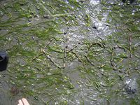
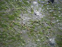
The deepest the water got was up to my ankles, and that was crossing a stream. For the most part I just walked a kilometre over wet sand, with perhaps the last 500 m having water up to my toes, with eel grass and little cone-shaped snails everywhere, so many I couldn't walk without stepping on them. Being barefoot (the beach shoes proved useless) on soft sand I don't think I hurt any of them.
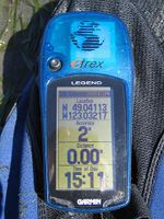
The wide open location gave excellent GPS lock and I easily found a position that gave me a stable 0.00 metres to the hash, with 2 m precision. I spelled out xkcd with the snails. I wasn't moving any one snail more than a foot or so, and I figured the soon turning tide would wash them all away anyhow, but my monument turned out to be even more ephemeral than I had thought. It happens that these snails are not nearly as sessile as I had presumed, and by the time the d was complete, some of the x had already crawled away. I took a few more pictures of the rapidly dispersing marker, and then trekked back to my bag and the shore.
There I encountered two dog walkers, one of whom turned out to be retired from my profession, so I cadged a ride back to the bus loop. I'm not sure if my hitchhiking or my walking nullify the transit achievement, and I'm still not sure if my destination was in water or on land, so I won't take any achievement ribbons today.
The Epilogue
To my horror, on examining my photographs, I see that I missed a digit in entering each the latitude and longitude on the GPS. I'm forced to call this unsuccessful after all. I wasn't in the right place, although perhaps one of my snails has made it there.
- Pictures


