2009-01-03 36 -77
From Geohashing
Revision as of 01:39, 4 January 2009 by imported>Ncbears (→Geological Features)
| Sat 3 Jan 2009 in 36,-77: 36.4861055, -77.9410178 geohashing.info google osm bing/os kml crox |
Contents
Report
Participants
Eisen & Bear - NCBears
Geological Features
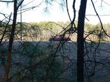
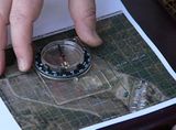
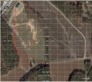
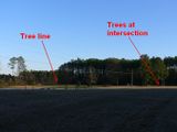
Rolling farmland (mostly corn and cotton). Geohash was located ~10 meters inside wooded area. About 375 meters from Lake Gaston and 4.0 miles/6.5 km south of the Virginia border. Open field between Geohash and road was used for corn crop. See Google Earth screenshot below.
Wildlife Encounters
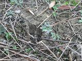
- White-tail deer prints in field
- Eastern Gray squirrel along road
- Heard Red-Tailed hawk cry (always cool)
Weather
52°F/11°C, clear skies
