2009-01-31 35 -78
| Sat 31 Jan 2009 in 35,-78: 35.9971020, -78.2379434 geohashing.info google osm bing/os kml crox |
Report
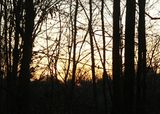
The graticule south of us had a hash too close to bypass and, according to Google Earth, was located on a public watershed on the edge of a trailer park. Since this area has a high crime rate and a recent homicide, we didn’t want to attempt a meetup. But a sunrise attempt may catch the area safer with most people sleeping – and it did. Unfortunately, it didn’t catch their dogs sleeping.
One dog began barking as soon as we entered the trailer park. We found an empty lot and made our way towards the Tar River and into a vicious patch of briars making up the wetlands buffer behind the trailer lots. The amount of recently tossed trash into the buffer was appalling. Soon the one vigilant dog was joined by at least three others and a relentless chorus of barking began.
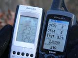
We made for the hash as quickly as possible (or at least to within the accuracy of the GPS), took the minimum amount of pictures, and high-tailed it out of the woods without attempting to geotrash.
We will pray for a happier hash when we attempt the meetup later today at N36 W77.
Participants
Eisen & Bear - NCBears
Geological Features
Rolling, heavy briars/underbrush. Edge of trailer park.
Wildlife Encounters
Multitude of barking dogs.
Weather
23.5°F/-4.7°C, clear skies


