2009-02-28 52 6
| Sat 28 Feb 2009 in 52,6: 52.2382246, 6.4560588 geohashing.info google osm bing/os kml crox |
Plan
There were two reasonably close hashes for Arvid, one at 35km, one at 40km. The second one looked like it was inside a barn though. The first was in a field, not that far from the Holterberg, the steepest hill of the province. Since I needed some hill-riding training I could combine something here.
To make it a little more complicated, my mom was over. She knows that I usually spent quite some hours cycling on saturdays. I thought she was staying another night, so I planned just to cycle in the afternoon, and be back before the evening.
My mom on the other hand, thought she'd leave and go to her brother in Deventer instead. Hey, that means I have nothing I have to take into account! I can cycle more! I could, for instance, go visit them after the hashpoint, since that's about halfway anyway.
If I would feel really well I could go over the Holterberg another time.
Achievements
- Arvid cycled 163.8km
Expedition
Arvid's tracklog by bicycle.
Story after lunch.
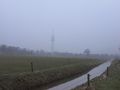
Hash is on the other side. Ditch a bit wider than expected.
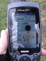
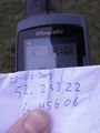
Time I was there.
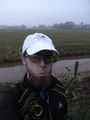
Sad hasher.
Ohey, an opportunity!
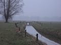
View the other way. Landmark alert.
Success!
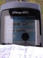
Time of success.
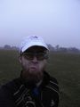
Happy&disappointed at the same time.
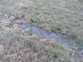
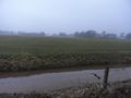
General state of the fields out there.
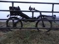
The machine.
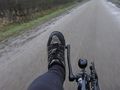
Soaked shoe (and sock).


