2009-03-24 67 21
| Tue 24 Mar 2009 in 67,21: 67.6026123, 21.1056386 geohashing.info google osm bing/os kml crox |
The hashpoint was next to the lake Yli Makkarajärvi south of Svappavaara.
the ru
Yli Makkarajärvi, literally "upper sausage lake" in finnish. Too awesome not to go.
There are also the middle and lower sausage lakes, but the upper is actually at the lowest altitude. A colleague suggested they might have be named after their relative latitudes instead.
This time I had brought and used a bottle of "quick grip" so I had no problem with slippery skiis.
E10
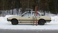
My vehicle: an Opel Ascona from 1983. It's older than me.
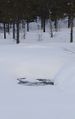
A spring. These sometimes don't freeze even in the winter.
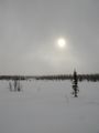
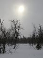
This bleak landscape I must wander. This is Sausage Lake, BTW.
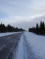
It started snowing...
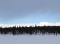
... but then the sky cleared up!
- 2009-03-24 67 21 proof.jpg
First time I've captured the hashpoint, myself and a perfectly zeroed GPS in the same photo.
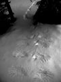
Todays animal tracks. Levels adjusted for clarity, the original was very bright.
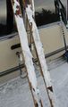
"Quick grip" almost worked a bit too well.


