2009-03-21 51 -1
| Sat 21 Mar 2009 in Swindon, United Kingdom: 51.7980280, -1.4404097 geohashing.info google osm bing/os kml crox |
The coordinates led to a small patch of trees in the middle of some farm land about 10 miles from Oxford. So I decided to set out on my bike and see if I could make it.
I got the point where I had to leave the road (without having to check my map) in about an hour, then took a close look at my print out and tried to find some land marks. Most of the ways towards the hashpoint where labelled Private, but I found one that wasn't, rode across a field, and into the woods. About 10 minutes later I arrived at what I hope was the hashpoint and stopped to have some lunch, take a few photos and leave my sign. All relatively uneventful. On the way back some caged dogs barked at me and just as I got back to the road I heard a shotgun fire, but I'm assuming it was just a bird-scarer. . .
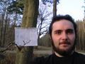
Me
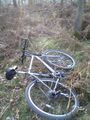
My Bike
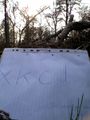
My sign and the hashpoint


