2010-06-25 46 11
| Fri 25 Jun 2010 in Trento: 46.5552863, 11.2434738 geohashing.info google osm bing/os kml crox |
Location
Today's location is in the forest on the slope of the Tschögglberg mountain near the road between Terlan/Terlano and Mölten/Meltina, not far from Bozen/Bolzano. It's at an elevation of about 900 meters.
Country: Italy; Region: Trentino-Südtirol/Trentino-Alto Adige (EU-IT-32); Province: Bozen-Südtirol/Bolzano-Alto Adige (EU-IT-BZ); comune: Mölten/Meltina
Expedition
Danatar
I was near Bozen on holidays and hoping for hashpoints in reach. I was lucky and this day's hashpoint was only 12 km from where we were staying, high up a mountain but near a road. I could have visited the hashpoint in the morning because I woke up much earlier than my friends, but one of them initially wanted to come with me, so I waited for a better opportunity. During the day we went hiking. Afterwards my possible drag-along wanted to watch the football world cup game Brazil-Portugal, so I went alone during the game.
It took me only a short time to reach Terlan, the village beneath the hashpoint (elevation ~250 meters). From there a road wound upwards to an elevation of ~1000 meters. At first I drove past the hashpoint, then I turned and stopped at the nearest possible location. I walked along a forest track until I was about 100 meters from the hashpoint, then I climbed down along a clearing in the forest. On the lower edge of the clearing I found a track, which I followed for a few metres, then I went down the slope to the hashpoint.
The spot was in a relatively steep part of the slope, but I could reach it without falling all the way down the mountain and drowning in the Etsch river. I took pictures (not enough for the panorama program to recognize enough overlap) and went back to the car. There was no good place to take pictures of the Etsch valley.
I knew already of the next day's hashpoint just a bit further along the road, and I had planned to take a look at it, but it was already later than planned, so I drove back.
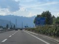
Terlan highway exit
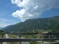
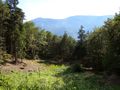
the Tschögglberg behind Terlan, the hashpoint marked as close as possible
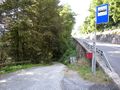
the first track towards the hashpoint
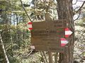
hiking tracks
100 m to go (in the forest down and to the left)
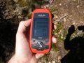
GPS

Coordinates reached! In Italy!
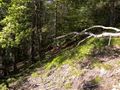
the hashpoint
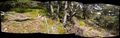
panorama creation failed


tracklog fail
I don't know what happened to the track that was created during the expedition, but the GPS receiver's memory tells me I spent a long time at 0.0° 0.0° on 1970-01-01. The hiking tours are lost, too.
The other GPS receiver made a track which is 200 meters off (both southsouthwest and upwards) for the biggest part of the expedition: see here