2012-04-07 54 -1
From Geohashing
Revision as of 21:47, 6 April 2012 by imported>ZeKieranator
| Sat 7 Apr 2012 in 54,-1: 54.1885982, -1.8898827 geohashing.info google osm bing/os kml crox |
Location
Participants
Plans
Expedition
Tracklog
Photos
Achievements
Location
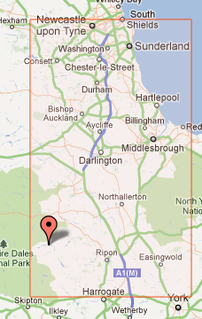
A field east of the Scar House Reservoir, which is in turn east of the Yorkshire Dales National Park.
Participants
zeKieranator, his family and some non-geohashing friends he's dragging along.
Plans
The hash is fairly close to the road, so we'll probably go there by car and walk the rest of the way.
