2012-06-22 48 11
From Geohashing
Revision as of 17:27, 22 June 2012 by imported>Zertrin (→Achievements)
| Fri 22 Jun 2012 in 48,11: 48.0739489, 11.4241655 geohashing.info google osm bing/os kml crox |
Location
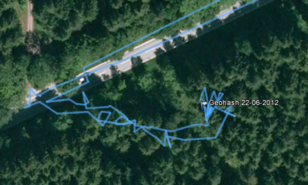
The hash was located in the forest, about 30 meter from the road between Neuried and Gauting, 10 km SW of Munich.
Participants
Plans
- 2012-06-22 48 11 An easy one tomorrow. I might go by bike in the end of the afternoon after university stuff. No ETA yet, but it should be between 16:00 and 18:30. — Zertrin 11:57, 21 June 2012 (EDT)
Expedition
After my last lecture this Friday, I took my bike and my brand new eTrex 20 that I got for birthday to ride to the hash. The trip was uneventful. Approaching the point, I went off the road to find a way to approach the hash. I parked my bike a few meter after entering the forest and the made the last 30 meters by foot. This was not very easy (again a lot of cut wood on the ground that makes the way difficult to cross...
I finally reached the haspoint, took some pictures and then went back to my home.
Tracklog
Photos
Achievements
Zertrin earned the Bicycle geohash achievement
|


