2012-08-16 27 -97
| Thu 16 Aug 2012 in 27,-97: 27.6656215, -97.3255988 geohashing.info google osm bing/os kml crox |
Location
Western shore of Oso Bay
Participants
- Applesandvodka
- His lovely wife.
Expedition
Got off work today, saw that the hashpoint was about 5 miles to the west of my apartment. From google maps, it looked like it would be a matter of parking on the side of the road and simply walking a hundred yards or so to the hashpoint.
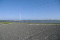
Decided to bring the wife along. We found out once we got there that what we thought was a road was actually a rather scenic footpath. Not that that is anything to complain about...except it was quite hot and muggy. Oh well, at least there was a nice south texas breeze.
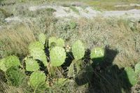
Anyway, we wound up walking along random sandy paths, until we came to a bit of tall grass with random cacti interspersed. As the wife and I were both wearing shorts and flip-flops, she stayed behind. Me, being foolish, decided to brave mother nature and hop through it, scraping up my legs in the process. Ow.
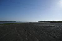
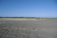
Anyway, once past the grass, a beautiful stretch of beach lay before me. I found the hashpoint, took some pictures, and then ran back through the grass to my wife, losing my sandle a couple of times in the process. Oh well.
Coordinates reached!
Photos
|
