2012-11-26 47 8
| Mon 26 Nov 2012 in 47,8: 47.2826774, 8.5131447 geohashing.info google osm bing/os kml crox |
Location
On Albis ridge.
Participants
Plans
Talashar often walks her dog in this area and has offered to give Calamus a lift. It should be ecologically okay as long as she's going there anyway.
Expedition
In Switzerland, almost any town has a Hausberg, a mountain it looks up to. Hausberge were vital in pre-webmap times, providing the only inexpensive way to overwatch the whole town. The Hausberg of Zurich is called the Uetliberg.
As Zurich lies in the Swiss flatlands, the Uetliberg isn't really a mountain by Swiss standards, surpassing the city by only 500 yards (465 metres). But apparently, it was the only suitable hill that could be found, and it's a really wunderful place to walk and relax. It can be conveniently reached by train (20 minutes from Zurich main station to the almost-summit) or by cableway, which is why a lot of Zurichois like to spend their freetime there.
Calamus had often been to the Uetliberg and the rest of Albis ridge with his family when he'd been a child, and still went there sometimes, either with friends or to get some quiet, but he didn't often have the time anymore. In fact, the last time he had gone on the ridge had been for the 2012-07-30 hashpoint. His mom Talashar, on the other hand, went there weekly to jog with her neighbour, although it had become more of a walk ever since she had troubles with her back.
When she got word that the hashpoint was on the ridge, she offered Calamus to give him a lift. While he could easily have taken the train as always, he gladly agreed.
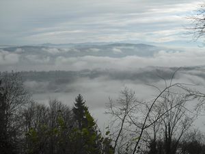
The four of them (Calamus, Talashar, Talashar's neighbour and Talashar's dog) drove to Adliswil, from where they took the cableway up to Felsenegg. They passed through a cloud while going up, a clear sign that winter was nigh. They wandered over towards the hashpoint, chatting. Rarely had Calamus walked past here, as Felsenegg was the typical spot to descend if one had wandered South from the Uetliberg. But they went past Buchenegg, the endpoint of the Uetliberg planet walk, and almost up to the Albis pass. There the hashpoint was, a tree trunk slightly off the path. Calamus went to get it (the rest of the party was less interested in it for some reason) and they returned the same way they had come.
Tracklog
Photos
Achievements
Calamus earned the Land geohash achievement
|
Calamus earned the Last man standing achievement
|


