User:Sourcerer/KML tool
From Geohashing
< User:Sourcerer
Revision as of 09:51, 25 January 2016 by imported>Sourcerer (→Bugs and feature requests)
Double check the output - it's not thoroughly tested yet!
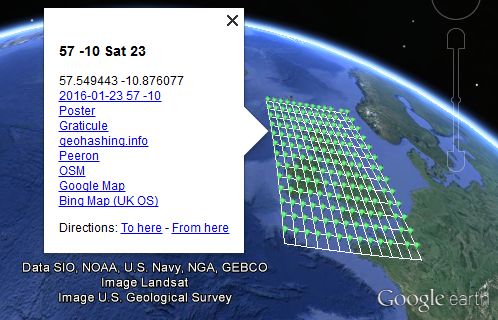
This calculator creates a KML file.
If Google Earth or another application that understands this file format is installed, it should launch and display the hashpoints for your specified date and graticule.
Usage
Use this input form or modify the web address below ...
http://nbest.co.uk/kmlGeohash/index.php?date=2008-05-21&lat=52&lon=0&skins=2
If any URL parameter is omitted, a default value is used instead.
- date - formatted yyyy-mm-dd - the default is today's date - alternatively try for example, 1 for tomorrow or -2 for the day before yesterday.
- lat - your graticule latitude - the default is 51 (Grenwich London).
- lon - your graticule longitude - the default is 0 (Grenwich London).
- skins - like an onion, the number of layers of points surrounding the home point - the default is 1 giving 9 hashpoints - the limits are 0 to 6.
- debug - check this or add '&debug=debug' to expose the guts of the algorithm.
Bugs and feature requests
Please put bug reports and feature requests on the discussion tab.
