File:2009-09-02 40 -105 monument.JPG
From Geohashing
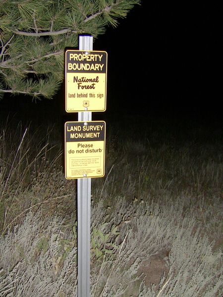
Revision as of 23:47, 8 September 2009 by imported>Cedarm (National Forest Property Boundry and Land Survey Monument signs at 40.291131, -105.343008. Category: Meetup on 2009-09-02 Category: Meetup in 40 -105)

Size of this preview: 450 × 600 pixels. Other resolutions: 180 × 240 pixels | 768 × 1,024 pixels.
Original file (768 × 1,024 pixels, file size: 478 KB, MIME type: image/jpeg)
National Forest Property Boundry and Land Survey Monument signs at 40.291131, -105.343008.
File history
Click on a date/time to view the file as it appeared at that time.
| Date/Time | Thumbnail | Dimensions | User | Comment | |
|---|---|---|---|---|---|
| current | 15:05, 30 January 2020 | | 768 × 1,024 (478 KB) | Maintenance script (talk | contribs) |
- You cannot overwrite this file.
File usage
The following 5 pages link to this file: