2021-10-21 -37 144
| Thu 21 Oct 2021 in -37,144: -37.7781264, 144.8550302 geohashing.info google osm bing/os kml crox |
Location
Next to Braybrook Primary School
Participants
Expeditions
Felix Dance
At last - a geohash within the accessible Melbourne metropolitan area rather than way out in the Moe direction. Of course I'd go get it.
Despite noticing it at 6am and theoretically being able to get there before work I waited until others could join in.
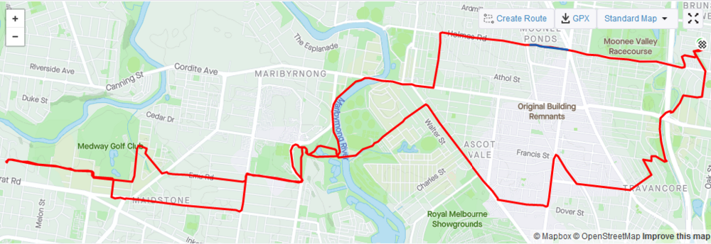
With Stevage meeting me out the front of my house at the crack of 6pm we rode off in a direct line towards the hash through the thick, warm air, which never quite threatened to rain but had a big, rainy, stormy feel to it all.
The direct route was a bit trafficky, especially at that evening peak time of day, but soon we were on the Maribyrnong River bike path and contending with a different kind of traffic in the form of evening walker-abouters - enjoying the last of their local exercise restrictions before "Freedom Day" tomorrow.
A steep climb and we were above the valley and negotiating the boundaries of the sprawling Highpoint Shopping Centre, a one-way street pointing in the wrong direction and finally the semi-industrial school zone of Braebrook Primary. We got to the kerb where the hash was, parked the bikes and beered up.
After not too much hanging out our good friends Lachie and LauraG arrived, themselves sadly beerless (not to worry - we sorted them out). We had some nice chats in the balmy air before declaring it a day and returning to our respective homes on our bikes, sojourning through more semi-industrial-semi-residential suburbs along the way.
Tracklog
Photos
Achievements
Stevage, Lachie, Felix Dance and Laura earned the Bicycle geohash achievement
|


