File:Geohash24thMay2009.jpg
From Geohashing
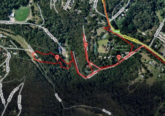
Revision as of 06:44, 25 May 2009 by imported>Felix Dance (This is the Gmaps Pedometer image of the location of the Geohash location for 2009-05-25 -37 144. The red line shows the rough expedition of Felix Dance on foot layered on top of the Google Maps satellite image.)
No higher resolution available.
Geohash24thMay2009.jpg (543 × 381 pixels, file size: 62 KB, MIME type: image/jpeg)
This is the Gmaps Pedometer image of the location of the Geohash location for 2009-05-25 -37 144. The red line shows the rough expedition of Felix Dance on foot layered on top of the Google Maps satellite image.
File history
Click on a date/time to view the file as it appeared at that time.
| Date/Time | Thumbnail | Dimensions | User | Comment | |
|---|---|---|---|---|---|
| current | 15:21, 30 January 2020 | | 543 × 381 (62 KB) | Maintenance script (talk | contribs) |
- You cannot overwrite this file.
File usage
The following page links to this file: