2009-05-27 33 -84
| Wed 27 May 2009 in Atlanta: 33.9797292, -84.1551980 geohashing.info google osm bing/os kml crox |
Graticule
About
Expedition
NWoodruff
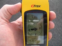
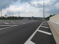
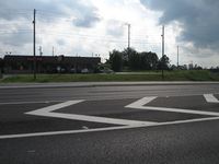
This turned out to be a real easy hash point. It is all of about 3 and a half miles from my house only about 2 miles out of my way going home from work. I parked on the side of the road with 200 feet or so to go. I walked the last 200 feet because there was no turn around once I got to the off ramp to Buford highyway. I also wanted to get to the exact spot and get a picture of the eTrex, which I knew would be difficult to do and drive at the same time.
I waited till the light was red at the intersection and then hopped out to the middle of the road and did a quick GPS dance before the light turned green. I got a picture of 1.25 feet to go and thought that was close enough.
I then walked back to my truck and turned around at the previous stop light and headed for home.
Gallery
- Photo Gallery
Achievements
NWoodruff earned the Land geohash achievement
|


