2009-06-27 52 8
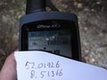
| Sat 27 Jun 2009 in 52,8: 52.0192602, 8.5136594 geohashing.info google osm bing/os kml crox |
Plan
Arvid learnt a week earlier that cycling up hills is still not something he's very skilled at. So he wanted to go to the Teutoburger woods, that stretch from about Ibbenbüren to the east. A hash between Osnabrück and Bielefeld would be good. This hash, just southwest of Bielefeld was very good. I've been on the road next to it on my previous Bielefeld hash, only 30m next to the hashpoint. I'm not all too sure whether the point is accessible, but only one way to find out!
Plan: Leave around 10:00, take the flat route to Bielefeld, and take some hills on the way back. I even found someone mad enough to go with me again(but it's the same guy for the third time).
Achievements
Expedition
Will all follow.
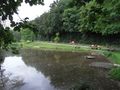
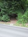
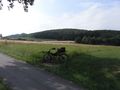
Pond. Hash is a little off the road next to the car in front.
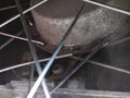
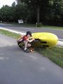
Broken spoke 1.
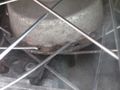
Broken spoke 2.
I left him with his bike.
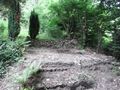
That's a convenient place for stairs.
Success!
I blame this for not getting the coordinates perfect on the photo.
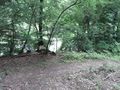
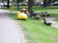
The hashpoint was some fireplace.
View down to the road from the hashpoint.
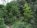
Track to the hashpoint.
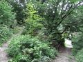
Track left, stairs right. The bright thing down there is the road.
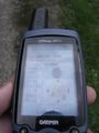
Proof of time&date.
He's still fiddling with his bike.
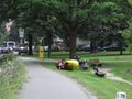
Stop on the way back.
Because of spokes being noisy again.

Hasher.


