2009-08-08 48 8
| Sat 8 Aug 2009 in 48,8: 48.5645846, 8.4527411 geohashing.info google osm bing/os kml crox |
Contents
Location
In the Black Forest, in the uppermost part of the Nagold valley, between Erzgrube and Besenfeld on a meadow.
Participants
Expedition
Summary: Went by bike via Bondorf to Nagold, then up the Nagold valley to the hash. Reached hash at 15:40. After 16:00 went further up to Besenfeld, from there down into the Murg valley, finally following that until Forbach. Took a train from Forbach to Rottenburg, did the rest by bike again.
Long report will be done later.
Technical data:
- Home to hash: 71.20 km by bike
- Hash to Forbach: 29.50 km by bike
- Forbach to Rottenburg: 92 km by train
- Rottenburg to home: 12.65 km by bike
- -> Total distance covered by bike: 113.35 km.
- Lowest point: ~320 m (near home)
- Highest point: 805 m (near Besenfeld)
- Total of uphill slopes: to be calculated. Probably not less than 800m.
Gallery
One picture every 60 minutes
I took one picture just whereever I was at that moment approximately every 60 minutes. Since I started at 8:50, that's always 10 minutes before the full hour. Reached home about 22:20.
09:50
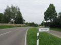
Almost reached Bondorf, currently passing a small hamlet named worm field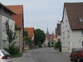
10:50
Passing Mötzingen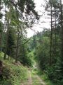
11:50
Just found a cache near Nagold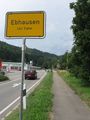
12:50
Reached Ebhausen. Following main road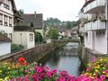
13:50
Looking for a supermarket to stock up on food at Altensteig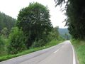
14:50
Up the Nagold valley on a secondary road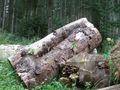
15:50
Waiting for 4 pm near hash. A heap of logs provides seats.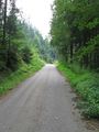
16:50
Leaving the valley on a steep forest track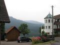
17:50
Giving my brakes a break after converting ~ 350 kJ of potential energy into heat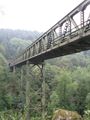
18:50
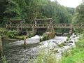
Standing under this bridge, trying to find a way for a stranger on my map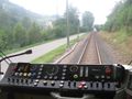
19:50
Train climbs the steep slope from Baiersbronn to Freudenstadt (rear view)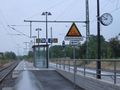
20:50
Waiting for connection at Hochdorf station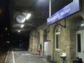
21:50
Reached Rottenburg


More pictures
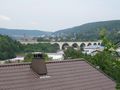
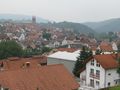
A view on the town of Nagold
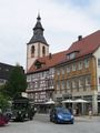
Within town
I'll try to explain what that is. As soon as I find those english words. Uh.
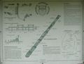
Here is explained what it is. In german only, sorry.
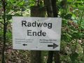
Cycleway ends here.
left: Continuing to Erzgrube only with offroad bikes
right: To Erzgrube continue on state highway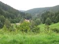
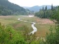
In the Nagold valley
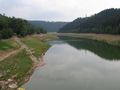
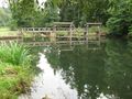
Nagold reservoir, almost empty
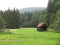
Near the hash
The hash itself
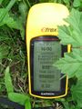
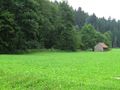
Coordinates reached
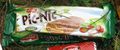
It's a picnic, isn't it?

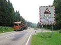
They're serious with the warning. Logging truck added for size comparison
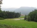
Almost down in the valley
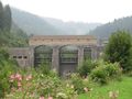
Kirschbaumwasen power plant
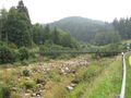
Not much water in there today
Final destination: Forbach


