2010-01-18 33 -84
| Mon 18 Jan 2010 in Atlanta: 33.9558121, -84.5967683 geohashing.info google osm bing/os kml crox |
Contents
Graticule
About
In Kennesaw Mountain National Battlefield Park.
Expedition
NWoodruff
I left work about 12:30 heading to the battlefield. I looked at my eTrex and it was 3.82 miles from where I worked. It was an actual 7 mile drive though as I couldn't drive over the river and through the woods.
I took the back roads to burnt creek drive and pulled into some parking spaces for the national battlefield. I was in luck as someone was pulling out just as I was driving up. That was the only parking space left out of say 30 or so parking spaces. I think I got lucky.
I got out of my truck and walked to the beginning of the trail. 0.55 of a mile to go. I took a few pictures and noticed that there was a number of fantastic looking women most all in very tight spandex either walking their dog or with there small kids. I managed to take a few pictures pretending to take pictures of the battlefield all while holding out my map of Kennesaw mountain. Fantastic scenery!
I headed off on the trail heading south. Every one was very friendly saying "Hi" as I passed. I even got a chance to throw a football(american) around with some 7 or 8 year olds for a few minutes. School is out today because of the holiday.
I set off on a brisk walk following my eTrex. I walked till my eTrex was pointing straight into the woods. 18.2 feet to go from the trail. I walked into the woods and found the Geohash spot with 3 feet to go. Close enough.
I took a few pictures and then made my way back to the trail. I figured with the distance from the trail and the accuracy of my eTrex that standing on the trail is still within the required 10 meters. That means that everyone that walked that trail today can claim Coordinates Reached.
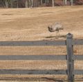
I then took a picture of the hash spot from the trail and walked the 0.55 of a mile back to my truck.
This time instead of driving back to Norcross, I actually made my way back to work.
Gallery
LuxMundi
I had to visit a project in Kennesaw, so I was able to swing by this hash mid-morning. The park covers almost 3,000 acres, but by happy coincidence, the hashpoint fell right beside a foot/horse path.
No horses today, but LOTS of walkers, joggers, and dogs.
Battle of Kennesaw Mountain:[1]
Gallery
Achievements
NWoodruff earned the Land geohash achievement
|
LuxMundi earned the Land geohash achievement
|
Planning
http://home.nps.gov/applications/parks/kemo/ppMaps/KEMOmap1.pdf
- Map of Kennesaw Mtn trails
- If you look at the trail map, the hash appears to be within a few meters of one of the trails, just north of Noses Creek.
- Possible parking spot
- this is the best??? trailhead, but looks like "no parking"
- Trailhead#3, again, no parking????
- bing maps
Summer 2006 and summer 2007 almost every day I would leave work and go climb the mountain with another web guy here at work. I'm very familiar with the trails and I didn't think I would have too much of a problem finding the hash spot. --NWoodruff 16:49, 15 January 2010 (UTC)


