2010-05-21 60 17
| Fri 21 May 2010 in 60,17: 60.0229115, 17.4999128 geohashing.info google osm bing/os kml crox |
Participants
- Jonatan
- Ulf
Expedition
This hashpedition was of a very spontaneous nature. I got the idea when I arrived at my parents' place in Uppsala, and twenty minutes later my father and me were off. Due to lack of time we had to use the car and not the bike as the main mode of transportation. It's a little bit pity, since it would have made a nice bike hash.
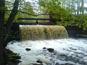
The way to the hash was quite nice, with two runestones and some nice remains of an old sawmill.
After some detours (mainly due to poorly paid attention thanks to having far interesting talks in the car) we arrived at a tiny road leading us to a dead-end in the middle of the forest. There, we left the car and went the last part by foot. As the forest was crowded with mosquitoes we made it to the hash point as fast as we could, took some quick pictures at the hash point and then hurriedly returned to the car. However, one has to say that even though there were quite many mosquitoes, most of them didn't seem to realize they were actually more or less served their meal of the week. Good for us, bad for them.
Achievements
Jonatan and Ulf earned the 2010 Geohashing Day achievement
|
Track Log
http://www.gpsed.com/track/294455182770322214


